Campo Municipal de Fútbol Los Barranquillos
Campo Municipal de Fútbol Los Barranquillos is a sports venue in Arafo, Santa Cruz de Tenerife. Campo Municipal de Fútbol Los Barranquillos is situated nearby to the reservoir Depósito Barranco Hondo Viejo (Alto), as well as near Depósito Barranco Hondo Nuevo.| Tap on a place to explore it |
Places of Interest Nearby
Highlights include Candelaria Thermal Power Plant and Ermita Nuestra Senora de la Candelaria.
Candelaria Thermal Power Plant
Power station
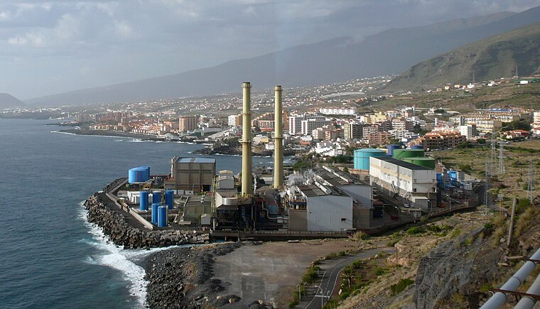
Photo: Jose Mesa, CC BY-SA 2.0.
Candelaria Thermal Power Plant is a power station, which is situated 1½ km south of Campo Municipal de Fútbol Los Barranquillos.
Ermita Nuestra Senora de la Candelaria
Church

Photo: Mike Peel, CC BY-SA 4.0.
Ermita Nuestra Senora de la Candelaria is a church, which is situated 3½ km north of Campo Municipal de Fútbol Los Barranquillos.
Deutsche Schule Santa Cruz de Tenerife
School
Deutsche Schule Santa Cruz de Tenerife is a German international school in the Tabaita Alta section of El Rosario, on the island of Tenerife in Spain, near Santa Cruz de Tenerife. It serves years 1–12, serving kindergarten through Oberstufe II. Deutsche Schule Santa Cruz de Tenerife is situated 3½ km northeast of Campo Municipal de Fútbol Los Barranquillos.
Places in the Area
Nearby places include Barranco Hondo and Las Caletillas.
Barranco Hondo
Suburb

Photo: Martely, CC BY-SA 4.0.
Barranco Hondo is a population entity belonging to the municipality of Candelaria, on the island of Tenerife, Canary Islands, Spain.
Tabaiba
Suburb

Photo: liferfe, CC BY-SA 2.0.
Tabaiba is a suburb, which is situated 3 km east of Campo Municipal de Fútbol Los Barranquillos.
Campo Municipal de Fútbol Los Barranquillos
- Type: Sports venue
- Categories: recreation area and sports location
- Location: Arafo, Santa Cruz de Tenerife, Canary Islands, Spain, Iberia, Europe
- View on OpenStreetMap
Latitude
28.39452° or 28° 23′ 40″ northLongitude
-16.36245° or 16° 21′ 45″ westOpen location code
7CW59JVQ+R2OpenStreetMap ID
way 620611909OpenStreetMap feature
leisure=sports_centre
This page is based on OpenStreetMap, Wikidata, and Wikimedia Commons.
We’d love your help improving our open data sources. Thank you for contributing.
Satellite Map
Discover Campo Municipal de Fútbol Los Barranquillos from above in high-definition satellite imagery.
Notable Places Nearby
Highlights include Depósito Barranco Hondo Viejo (Alto) and Depósito Barranco Hondo Nuevo.
Nearby Places
Explore places such as Cementerio and La Angostura.
Canary Islands: Must-Visit Destinations
Delve into Santa Cruz de Tenerife, Las Palmas, La Palma, and La Gomera.
Curious Sports Venues to Discover
Uncover intriguing sports venues from every corner of the globe.
About Mapcarta. Data © OpenStreetMap contributors and available under the Open Database License". Text is available under the CC BY-SA 4.0 license, except for photos, directions, and the map. Photo: Wikimedia, CC BY-SA 4.0.