Stadtpunkt Fugenlos
Stadtpunkt Fugenlos is an office in Coburg, Upper Franconia, Bavaria which is located on Herrngasse. Stadtpunkt Fugenlos is situated nearby to the tourism office Tourist-Information, as well as near the fountain Gurken-Alex-Brunnen.| Tap on a place to explore it |
Places of Interest Nearby
Highlights include Rathaus and Marktplatz Coburg.
Rathaus
Town hall
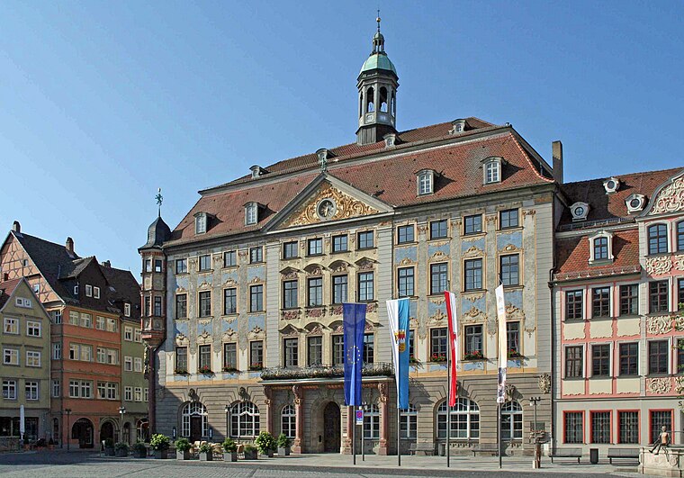
Photo: Störfix, CC BY-SA 3.0.
Rathaus is a town hall, which is situated 130 metres southwest of Stadtpunkt Fugenlos.

Landestheater Coburg
Theater building
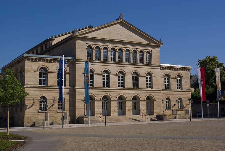
Photo: Mike aus dem Bayerwald, CC BY-SA 3.0.
Landestheater Coburg is a medium-sized three-division theatre in Coburg, Bavaria, Germany. Located on Schlossplatz, a central square, the Neoclassical building has 550 seats. In 2008, the theatre employed 250 permanent staff and 100 part-time employees. Landestheater Coburg is situated 170 metres northeast of Stadtpunkt Fugenlos.
Places in the Area
Nearby places include Festungshof and Ketschendorf.

Ketschendorf
Suburb

Photo: Störfix, CC BY-SA 3.0 de.
Ketschendorf is a southern suburb of the city of Coburg in the county of Upper Franconia, in the state of Bavaria in Germany.
Cortendorf
Suburb

Photo: Störfix, CC BY-SA 3.0 de.
Cortendorf is a north-eastern district of the Bavarian city of Coburg. With a population of 1.349 and a size of 1.65 square kilometres it has a population density of 818 inhabitants/km2.
Stadtpunkt Fugenlos
- Type: Educational institution
- Address: Herrngasse 7, Coburg, 96450
- Categories: office and education
- Location: Coburg, Coburg, Upper Franconia, Franconia, Bavaria, Germany, Central Europe, Europe
- View on OpenStreetMap
Latitude
50.25858° or 50° 15′ 31″ northLongitude
10.96578° or 10° 57′ 57″ eastOperator
Hochschule CoburgOpen location code
9F2G7X58+C8OpenStreetMap ID
way 624366778OpenStreetMap feature
office=educational_institution
This page is based on OpenStreetMap, Wikidata, and Wikimedia Commons.
We’d love your help improving our open data sources. Thank you for contributing.
Satellite Map
Discover Stadtpunkt Fugenlos from above in high-definition satellite imagery.
Notable Places Nearby
Highlights include Tourist-Information and Gurken-Alex-Brunnen.
Nearby Places
Explore places such as Pizzaiolo and Dr. med. Peter Schnaus.
Upper Franconia: Must-Visit Destinations
Delve into Bamberg, Bayreuth, Hof, and Kulmbach.
Curious Places to Discover
Uncover intriguing places from every corner of the globe.
About Mapcarta. Data © OpenStreetMap contributors and available under the Open Database License". Text is available under the CC BY-SA 4.0 license, except for photos, directions, and the map. Photo: Benreis, CC BY 3.0.