Urbanización Dulce Nombre de Jesús
Urbanización Dulce Nombre de Jesús is a residential area in Heredia Province, Costa Rica. Urbanización Dulce Nombre de Jesús is situated nearby to the park Parque Dulce Nombre, as well as near Parque El Solar.| Tap on a place to explore it |
Places of Interest Nearby
Highlights include Eladio Rosabal Cordero Stadium and Tobías Bolaños International Airport.
Eladio Rosabal Cordero Stadium

Photo: Alofaga, CC BY-SA 3.0.
Estadio Eladio Rosabal Cordero was a multi-purpose stadium in Heredia, Costa Rica. The stadium held 8,700 people and opened in 1949. It was mostly used for football matches and was the home stadium of Herediano. Eladio Rosabal Cordero Stadium is situated 2 km northeast of Urbanización Dulce Nombre de Jesús.
Tobías Bolaños International Airport
Aerodrome
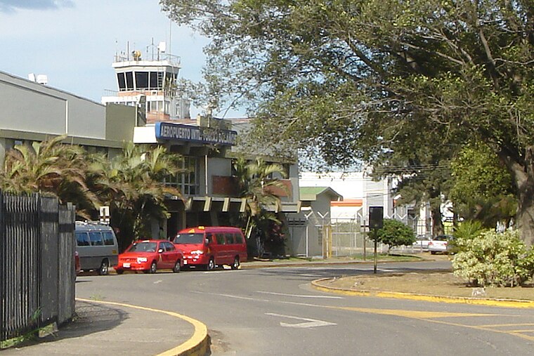
Photo: Mariordo, CC BY-SA 3.0.
Tobías Bolaños International Airport is one of four international airports in Costa Rica, and the secondary airport serving the city of San José, after Juan Santamaría International Airport. Tobías Bolaños International Airport is situated 3½ km south of Urbanización Dulce Nombre de Jesús.
Hospital San Vicente de Paúl
Hospital
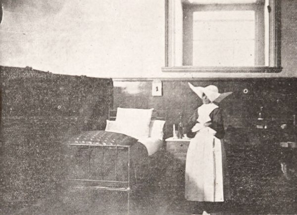
Photo: Wikimedia, Public domain.
Hospital San Vicente de Paúl is situated 1½ km east of Urbanización Dulce Nombre de Jesús.
Places in the Area
Nearby places include Heredia and Barva.
Heredia

Photo: Rquesada, CC BY-SA 3.0.
Heredia region of the Central Valley offers much for the visitor in downtown Heredia, and in many of the towns around Heredia, particularly in the north mountains, like Barva, San Rafael, San Isidro, where there are many coffee plantations and fresh air year round.
Barva
Town

Photo: Tillor87, CC BY-SA 3.0.
Barva is a district of the Barva canton, in the Heredia province of Costa Rica. The city is known for having a nice mix of rural and metropolitan landscape. Barva is situated 4 km north of Urbanización Dulce Nombre de Jesús.
Uruca
Village
Uruca is the seventh district of the San José canton, in the San José province of Costa Rica. It is an important industrial and commercial area of San José. Uruca is situated 6 km southeast of Urbanización Dulce Nombre de Jesús.
Urbanización Dulce Nombre de Jesús
- Type: Residential area
- Location: Heredia Province, Costa Rica, Central America, North America
- View on OpenStreetMap
Latitude
9.98775° or 9° 59′ 16″ northLongitude
-84.13753° or 84° 8′ 15″ westOpen location code
66XQXVQ6+3XOpenStreetMap ID
way 624874269OpenStreetMap feature
landuse=residential
This page is based on OpenStreetMap, Wikidata, and Wikimedia Commons.
We’d love your help improving our open data sources. Thank you for contributing.
Satellite Map
Discover Urbanización Dulce Nombre de Jesús from above in high-definition satellite imagery.
Notable Places Nearby
Highlights include Parque Dulce Nombre and Parque El Solar.
Nearby Places
Explore places such as Urb. El Solar and Panadería Mi Terruño.
Costa Rica: Must-Visit Destinations
Delve into San José, Alajuela, Puerto Limón, and Liberia.
Curious Residential Areas to Discover
Uncover intriguing residential areas from every corner of the globe.
About Mapcarta. Data © OpenStreetMap contributors and available under the Open Database License". Text is available under the CC BY-SA 4.0 license, except for photos, directions, and the map. Photo: Henry Zbyszynski, CC BY 2.0.