L
L is a hospital building in Saint-Étienne, Loire, Auvergne-Rhône-Alpes. L is situated nearby to the hospital Hôpital de La Charité, as well as near the church Chapelle de La Charité (Saint-Étienne).| Tap on a place to explore it |
Places of Interest Nearby
Highlights include Hôpital de La Charité and Chapelle de La Charité (Saint-Étienne).
Hôpital de La Charité
Hospital

Photo: Dvillafruela, CC BY-SA 3.0.
Hôpital de La Charité is a hospital.
Chapelle de La Charité (Saint-Étienne)
Church

Photo: Georgespitiot, CC BY-SA 3.0.
Chapelle de La Charité (Saint-Étienne) is a church.
Musée d’Art et d’Industrie de Saint-Étienne
Museum
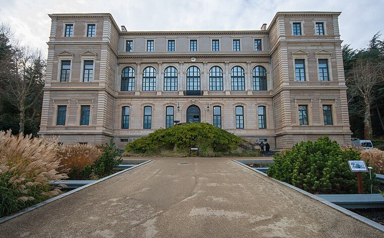
Photo: MirandaAdramin, CC BY-SA 3.0.
Musée d’Art et d’Industrie de Saint-Étienne is a museum, which is situated 400 metres west of L.
Places in the Area
Nearby places include Châteaucreux and Montaud.

Montaud
Neighborhood
Montaud is a former French commune of the Loire on the north west of the city of Saint-Étienne. It was created during the French revolution then included in Saint-Étienne in 1855. Montaud is situated 3 km northwest of L.
La Ricamarie
Village
La Ricamarie is a commune in the Loire department in central France. It is situated between the city of Saint-Etienne and the town of Firminy. La Ricamarie is situated 4 km southwest of L.
L
- Type: Hospital building
- Categories: building and health care
- Location: Saint-Étienne, Arrondissement of Saint-Étienne, Loire, Greater Lyon, Auvergne-Rhône-Alpes, France, Europe
- View on OpenStreetMap
Latitude
45.43234° or 45° 25′ 56″ northLongitude
4.39181° or 4° 23′ 31″ eastOpen location code
8FQ6C9JR+WPOpenStreetMap ID
way 63255585OpenStreetMap feature
building=hospital
This page is based on OpenStreetMap, Wikidata, and Wikimedia Commons.
We’d love your help improving our open data sources. Thank you for contributing.
Satellite Map
Discover L from above in high-definition satellite imagery.
Notable Places Nearby
Highlights include Place Jean Grivolat and Les Trois Ducs.
Nearby Places
Explore places such as Delphine Création and M.
Greater Lyon: Must-Visit Destinations
Delve into Lyon, Roanne, Villefranche-sur-Saône, and Divonne-les-Bains.
Curious Places to Discover
Uncover intriguing places from every corner of the globe.
About Mapcarta. Data © OpenStreetMap contributors and available under the Open Database License". Text is available under the CC BY-SA 4.0 license, except for photos, directions, and the map. Photo: Dvillafruela, CC BY-SA 3.0.