The Trolley Yard
The Trolley Yard is a commercial area in Worcester, Massachusetts. The Trolley Yard is situated nearby to the health club Orangetheory Fitness, as well as near the sports venue X-Golf Worcester.| Tap on a place to explore it |
Places of Interest Nearby
Highlights include American Antiquarian Society and Clark University.
American Antiquarian Society
Library

Photo: Magicpiano, CC BY-SA 4.0.
The American Antiquarian Society, located in Worcester, Massachusetts, is both a learned society and a national research library of pre-twentieth-century American history and culture. American Antiquarian Society is situated 2,100 feet southwest of The Trolley Yard.
Clark University
University
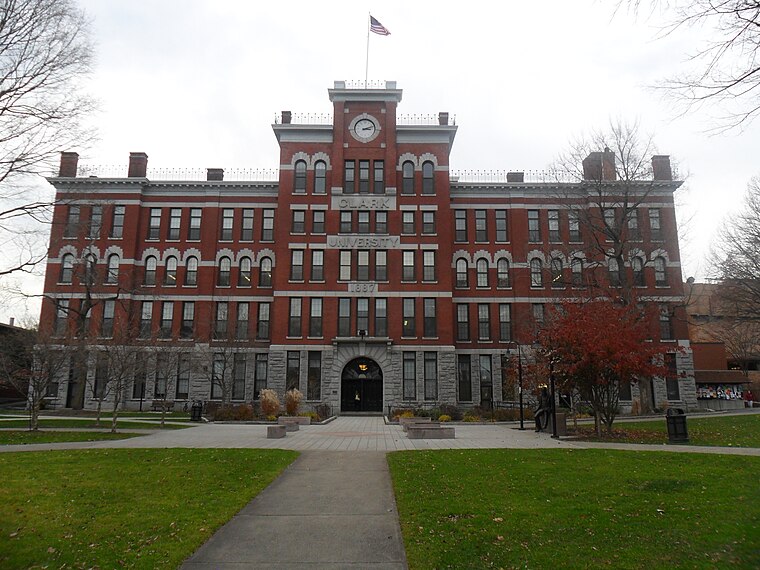
Photo: Namiba, Public domain.
Clark University is a private research university in Worcester, Massachusetts, United States. Founded in 1887 with a large endowment from its namesake Jonas Gilman Clark, a prominent businessman, Clark was one of the first modern research universities in the United States. Clark University is situated 1 mile south of The Trolley Yard.
Institute Park
Park

Photo: Kzirkel, CC BY-SA 4.0.
Institute Park is a public park in Worcester, Massachusetts. Founded on donated land in 1887, it is located next to the campus of Worcester Polytechnic Institute. The park is 24.6 acres in size.
Places in the Area
Nearby places include Massachusetts Avenue Historic District and Hammond Heights.
Massachusetts Avenue Historic District
Neighborhood

Photo: Pvmoutside, CC BY-SA 3.0.
The Massachusetts Avenue Historic District in Worcester, Massachusetts is a 5-acre historic district that was listed on the National Register of Historic Places in 1971.
Hammond Heights
Hamlet
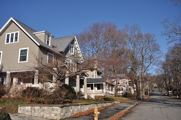
Photo: Magicpiano, CC BY-SA 4.0.
Hammond Heights is an historic neighborhood subdivision on the west side of Worcester, Massachusetts. It includes properties along Germain, Haviland, Highland, and Westland Streets and Institute Road, most of which were built between 1890 and 1918, and is a good example of a turn-of-the-century residential subdivision, with a diversity of period architectural styles.
Lincoln Estate–Elm Park Historic District
Neighborhood

Photo: Faolin42, CC BY-SA 3.0.
The Lincoln Estate–Elm Park Historic District is an expansive residential area in northwestern Worcester, Massachusetts. It is centered on Cedar and William Streets, and includes properties on adjacent streets.
The Trolley Yard
- Type: Commercial area
- Location: Worcester, Massachusetts, New England, United States, North America
- View on OpenStreetMap
Latitude
42.28249° or 42° 16′ 57″ northLongitude
-71.80729° or 71° 48′ 26″ westOpen location code
87JC75JV+X3OpenStreetMap ID
way 633051363OpenStreetMap feature
landuse=retail
This page is based on OpenStreetMap, Wikidata, and Wikimedia Commons.
We’d love your help improving our open data sources. Thank you for contributing.
Satellite Map
Discover The Trolley Yard from above in high-definition satellite imagery.
Notable Places Nearby
Highlights include Orangetheory Fitness and X-Golf Worcester.
Nearby Places
Explore places such as 30 The Trolley Stop and Revive Behavioral Health, PLLC.
Massachusetts: Must-Visit Destinations
Delve into Boston, Cambridge, Springfield, and Worcester.
Curious Commercial Areas to Discover
Uncover intriguing commercial areas from every corner of the globe.
About Mapcarta. Data © OpenStreetMap contributors and available under the Open Database License". Text is available under the CC BY-SA 4.0 license, except for photos, directions, and the map. Photo: papadunes, CC BY-SA 3.0.