Estación Experimental Santa Lucía - UNA
Estación Experimental Santa Lucía - UNA is a forest in Santa Lucía, Barva, Heredia Province. Estación Experimental Santa Lucía - UNA is situated nearby to the neighborhood Paso Viga, as well as near Pedregal.| Tap on a place to explore it |
Places of Interest
Highlights include Museo de Cultura Popular and Eladio Rosabal Cordero Stadium.
Museo de Cultura Popular
Museum
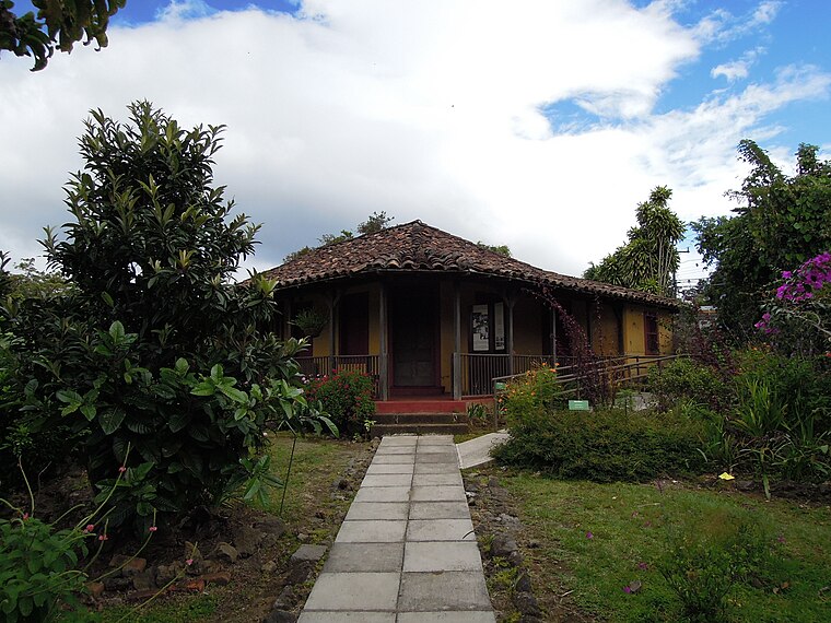
Photo: Rquesada, CC BY-SA 3.0.
Museo de Cultura Popular is a museum in the district of Santa Lucía, just south of Barva, Costa Rica. It is located in the former home of ex-president Alfredo González Flores.
Eladio Rosabal Cordero Stadium

Photo: Alofaga, CC BY-SA 3.0.
Estadio Eladio Rosabal Cordero was a multi-purpose stadium in Heredia, Costa Rica. The stadium held 8,700 people and opened in 1949. It was mostly used for football matches and was the home stadium of Herediano.
Parroquia San Bartolomé Apóstol
Church

Photo: Tillor87, CC BY-SA 3.0.
The Parroquia San Bartolomé Apóstol, is a church in Barva, Heredia, Costa Rica. The first church was established between 1568 and 1575, and dedicated to Saint Bartholomew; it is rumored to have been built on an indigenous burial ground.
Places in the Area
Nearby places include Heredia and Barva.
Heredia

Photo: Rquesada, CC BY-SA 3.0.
Heredia region of the Central Valley offers much for the visitor in downtown Heredia, and in many of the towns around Heredia, particularly in the north mountains, like Barva, San Rafael, San Isidro, where there are many coffee plantations and fresh air year round.
Barva
Town
Photo: Tillor87, CC BY-SA 3.0.
Barva is a district of the Barva canton, in the Heredia province of Costa Rica. The city is known for having a nice mix of rural and metropolitan landscape.
San José de la Montaña District
Village

Photo: Victor Quirós A, CC BY-SA 3.0.
San José de la Montaña is a district of the Barva canton, in the Heredia province of Costa Rica.
Estación Experimental Santa Lucía - UNA
- Type: Forest
- Location: Santa Lucía, Barva, Heredia Province, Costa Rica, Central America, North America
- View on OpenStreetMap
Latitude
10.025° or 10° 1′ 30″ northLongitude
-84.1127° or 84° 6′ 46″ westOpen location code
762Q2VGP+2WOpenStreetMap ID
way 633768708OpenStreetMap feature
landuse=forest
This page is based on OpenStreetMap, Wikidata, and Wikimedia Commons.
We’d love your help improving our open data sources. Thank you for contributing.
Satellite Map
Discover Estación Experimental Santa Lucía - UNA from above in high-definition satellite imagery.
Localities in the Area
Explore places such as Paso Viga and Pedregal.
Notable Places Nearby
Highlights include Centro Recreativo Fondo de Beneficio Social - UNA and Parque Don Álvaro.
Costa Rica: Must-Visit Destinations
Delve into San José, Alajuela, Puerto Limón, and Liberia.
Curious Forests to Discover
Uncover intriguing forests from every corner of the globe.
About Mapcarta. Data © OpenStreetMap contributors and available under the Open Database License". Text is available under the CC BY-SA 4.0 license, except for photos, directions, and the map. Photo: Henry Zbyszynski, CC BY 2.0.