Harwood Lane
Harwood Lane is a residential area in Bonhomme Township, St. Louis County, Missouri. Harwood Lane is situated nearby to the sports venue Convocation and Athletic Center, as well as near the village Oakland.| Tap on a place to explore it |
Places of Interest Nearby
Highlights include Kirkwood Public Library and Kirkwood station.
Kirkwood Public Library
Library
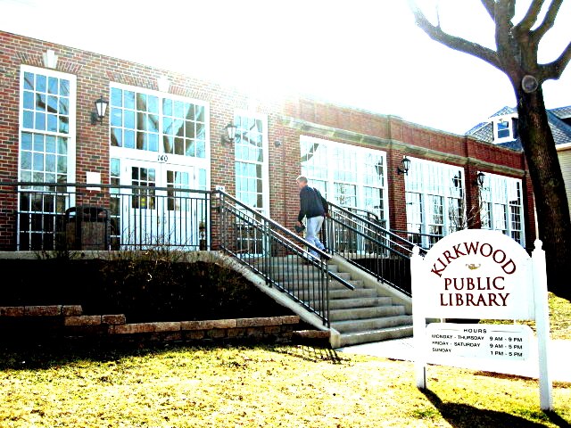
Photo: Mary A. Guillory, CC BY-SA 3.0.
Kirkwood Public Library primarily serves residents of the city of Kirkwood, Missouri, USA. The library is operated independently, and is a part of the Municipal Library Consortium of St. Kirkwood Public Library is situated 1 mile west of Harwood Lane.
Kirkwood station
Railway station
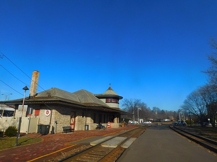
Photo: Wikimedia, CC BY-SA 2.0.
Kirkwood station, also called the Kirkwood Missouri Pacific Depot, is a suburban Amtrak train station in Kirkwood, Missouri, United States. Located in downtown Kirkwood, it is one of four Amtrak stations in the St. Kirkwood station is situated 1 mile west of Harwood Lane.
Kirkwood High School
School
Kirkwood High School is a public secondary school in Kirkwood, Missouri, United States. The school is part of the Kirkwood R-7 School District. Kirkwood High School is situated 2 miles northwest of Harwood Lane.
Places in the Area
Nearby places include Oakland and Kirkwood.
Oakland
Village
Oakland is a city in St. Louis County, Missouri, United States. The population was 1,381 at the 2010 census.
Kirkwood
Town
Photo: Rwhealey, CC BY-SA 3.0.
St. Louis County is an area in the St. Louis Area of Missouri. Its current boundaries were set in 1877, when St. Louis City split off to become an independent city separate from any county.
Glendale
Village
Glendale is a city in St. Louis County, Missouri, United States. The population was 5,925 at the 2010 census.
Harwood Lane
Latitude
38.57789° or 38° 34′ 40″ northLongitude
-90.38969° or 90° 23′ 23″ westOpen location code
86CFHJH6+54OpenStreetMap ID
way 633972421OpenStreetMap feature
landuse=residential
This page is based on OpenStreetMap, Wikidata, and Wikimedia Commons.
We’d love your help improving our open data sources. Thank you for contributing.
Satellite Map
Discover Harwood Lane from above in high-definition satellite imagery.
Notable Places Nearby
Highlights include Convocation and Athletic Center and Grants Trail - Kirkwood Trailhead.
Nearby Places
Explore places such as Auditorium and Gray Oaks.
St. Louis Area: Must-Visit Destinations
Delve into St. Louis, Ferguson, and St. Charles.
Curious Residential Areas to Discover
Uncover intriguing residential areas from every corner of the globe.
About Mapcarta. Data © OpenStreetMap contributors and available under the Open Database License". Text is available under the CC BY-SA 4.0 license, except for photos, directions, and the map. Photo: Wikimedia, CC BY-SA 4.0.