Rausch Schokoladen-Manufaktur
Rausch Schokoladen-Manufaktur is a building in Berlin, Berlin. Rausch Schokoladen-Manufaktur is situated nearby to the government office Jugendberufsagentur Berlin, as well as near the theater building Theatersaal.| Tap on a place to explore it |
Places of Interest Nearby
Highlights include UfaFabrik and Ullsteinstraße.

Ullsteinstraße
Metro station

Photo: Phaeton1, CC BY-SA 3.0.
Ullsteinstraße is a Berlin U-Bahn station located on the U6 line. The station was designed by R. G. Rümmler and opened in 1966. The station is located below B96, where it crosses the Teltow Canal via the Stubenrauch Bridge. Ullsteinstraße is situated 280 metres east of Rausch Schokoladen-Manufaktur.
Tempelhofer Hafen
Shopping center
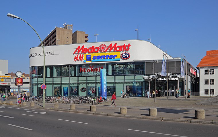
Photo: A.Savin, CC BY-SA 3.0.
Tempelhofer Hafen is a shopping center, which is situated 450 metres northeast of Rausch Schokoladen-Manufaktur.
Places in the Area
Nearby places include Tempelhof and Neukölln and Rote Insel.
Tempelhof and Neukölln

Photo: Brücke-Osteuropa, CC0.
Tempelhof and Neukölln are two districts in the central south of Berlin.
Rote Insel
Quarter
Rote Insel is the name colloquially given to a neighborhood in the Schöneberg district of the German capital, Berlin. As such, the neighborhood is part of Berlin's 7th administrative borough, Tempelhof-Schöneberg. Rote Insel is situated 3½ km north of Rausch Schokoladen-Manufaktur.
Viktoria-Quartier
Neighborhood

Photo: Wikimedia, CC BY-SA 3.0 de.
Viktoria-Quartier is a neighborhood, which is situated 3½ km north of Rausch Schokoladen-Manufaktur.
Rausch Schokoladen-Manufaktur
- Type: Building
- Also known as: “Fassbender & Rausch”
- Location: Berlin, Berlin, Stadt, Berlin, Germany, Central Europe, Europe
- View on OpenStreetMap
Latitude
52.45361° or 52° 27′ 13″ northLongitude
13.38041° or 13° 22′ 50″ eastLevels
4Open location code
9F4MF93J+C5OpenStreetMap ID
way 63636473OpenStreetMap feature
building=yes
This page is based on OpenStreetMap, Wikidata, and Wikimedia Commons.
We’d love your help improving our open data sources. Thank you for contributing.
Satellite Map
Discover Rausch Schokoladen-Manufaktur from above in high-definition satellite imagery.
Notable Places Nearby
Highlights include Jugendberufsagentur Berlin and Theatersaal.
Nearby Places
Explore places such as Walter Confiserie Werksverkauf and Agentur für Arbeit.
Berlin: Must-Visit Destinations
Delve into Mitte, East Central, City West, and East Berlin.
Curious Buildings to Discover
Uncover intriguing buildings from every corner of the globe.
About Mapcarta. Data © OpenStreetMap contributors and available under the Open Database License". Text is available under the CC BY-SA 4.0 license, except for photos, directions, and the map. Photo: Berthold Werner, CC BY-SA 3.0.