Le Sainte-Luce A
Le Sainte-Luce A is a building in Cagnes-sur-Mer, Arrondissement of Grasse, Provence-Alpes-Côte d’Azur. Le Sainte-Luce A is situated nearby to the village green Place De Gaulle, as well as near the police station Police municipale.| Tap on a place to explore it |
Places of Interest Nearby
Highlights include Château Grimaldi and Cagnes sur Mer Railway Station.
Château Grimaldi
Museum

Photo: Ariadacapo, CC BY 4.0.
The Château Grimaldi at Cagnes-sur-Mer in the département of Alpes-Maritimes, in France, is built on the site of an earlier fortress occupied by the Greeks and then the Romans. Château Grimaldi is situated 480 metres northwest of Le Sainte-Luce A.
Cagnes sur Mer Railway Station
Railway station
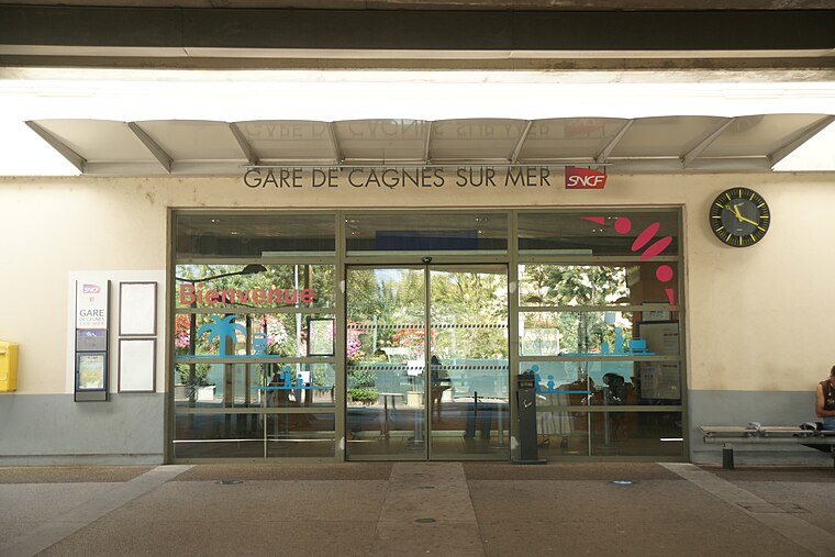
Photo: Dacoucou, CC BY-SA 4.0.
Gare de Cagnes-sur-Mer is a railway station serving Cagnes-sur-Mer, Alpes-Maritimes department, southeastern France. It is located on the Marseille–Ventimiglia railway, between Cannes and Nice. Cagnes sur Mer Railway Station is situated 730 metres south of Le Sainte-Luce A.
St Pierre & St Paul church
Church

Photo: Finoskov, CC BY-SA 4.0.
St Pierre & St Paul church is situated 460 metres northwest of Le Sainte-Luce A.
Places in the Area
Nearby places include Villeneuve-Loubet and Saint-Laurent-du-Var.
Villeneuve-Loubet
Town

Photo: Ariadacapo, CC BY 4.0.
Villeneuve-Loubet is a commune in the Alpes-Maritimes department in the Provence-Alpes-Côte d'Azur region in Southeastern France. It lies between Cagnes-sur-Mer and Antibes, at the mouth of the river Loup, ten kilometres west of central Nice.
Saint-Laurent-du-Var
Town

Photo: HenrikKbh, CC BY-SA 3.0.
Saint-Laurent-du-Var is a commune in the Alpes-Maritimes department in the Provence-Alpes-Côte d'Azur region on the French Riviera. Saint-Laurent-du-Var is situated 3½ km east of Le Sainte-Luce A.
Saint-Paul de Vence

Photo: Dennis G. Jarvis, CC BY-SA 2.0.
St.-Paul-de-Vence, in Alpes-Maritimes, France, is a perfectly preserved medieval village perched on a hillside several kilometres from the Mediterranean.
Le Sainte-Luce A
Latitude
43.66417° or 43° 39′ 51″ northLongitude
7.14997° or 7° 8′ 60″ eastOpen location code
8FM9M47X+MXOpenStreetMap ID
way 63878707OpenStreetMap feature
building=yes
This page is based on OpenStreetMap, Wikidata, and Wikimedia Commons.
We’d love your help improving our open data sources. Thank you for contributing.
Satellite Map
Discover Le Sainte-Luce A from above in high-definition satellite imagery.
Notable Places Nearby
Highlights include Place De Gaulle and Police municipale.
Nearby Places
Explore places such as Richard Service and Garage JMS.
Alpes-Maritimes: Must-Visit Destinations
Delve into Nice, Cannes, Antibes, and Menton.
Curious Buildings to Discover
Uncover intriguing buildings from every corner of the globe.
About Mapcarta. Data © OpenStreetMap contributors and available under the Open Database License". Text is available under the CC BY-SA 4.0 license, except for photos, directions, and the map. Photo: Kulmalukko, CC BY-SA 3.0.