School One Lofts
School One Lofts is a building in Troy, Rensselaer, New York. School One Lofts is situated nearby to St. Barnabas Episcopal Church, as well as near New Hope Missionary Baptist Church.| Tap on a place to explore it |
Places of Interest Nearby
Highlights include St. Barnabas Episcopal Church and Stomy Island.
St. Barnabas Episcopal Church
Church
St. Barnabas Episcopal Church, later called Christ & St. Barnabas Episcopal Church, and now known as New Hope Missionary Baptist Church, is an historic Episcopal church and rectory at 2900 Fifth Avenue in Troy, Rensselaer County, New York.
Stomy Island
Islet
The Hudson River in New York and New Jersey is full of islands, though some have been filled in to connect to the shore. Some of the islands have the Hudson on one side and have another river or creek on the other side.
Kate Mullany House
Museum
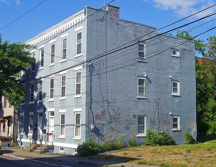
Photo: Daniel Case, CC BY-SA 3.0.
The Kate Mullany House was the home of Kate Mullany, an early female labor leader who started the all-women Collar Laundry Union in Troy, New York in February 1864. Kate Mullany House is situated 2,500 feet south of School One Lofts.
Places in the Area
Nearby places include Green Island and Watervliet.
Green Island
Village

Photo: Wikimedia, CC BY-SA 2.0.
Green Island is a coterminous town-village in Albany County, New York, United States, some 8 miles north of Albany. Green Island is one of only five such town-village amalgamations in New York.
Watervliet
Photo: UpstateNYer, CC BY-SA 3.0.
Watervliet is a city in northeastern Albany County, New York, United States. The population was 10,375 as of the 2020 census. Watervliet is north of Albany, the capital of the state, and is bordered on the north, west, and south by the town of Colonie.
Cohoes

Photo: Traveler100, CC BY-SA 4.0.
Cohoes is a city in Albany County on the confluence of the Mohawk and Hudson Rivers, where the Mohawk forms several channels and islands.
School One Lofts
- Type: Building
- Location: Troy, Rensselaer, Capital District, New York, Mid-Atlantic, United States, North America
- View on OpenStreetMap
Latitude
42.74688° or 42° 44′ 49″ northLongitude
-73.68242° or 73° 40′ 57″ westOpen location code
87J8P8W9+Q2OpenStreetMap ID
way 639169178OpenStreetMap feature
building=yes
This page is based on OpenStreetMap, Wikidata, and Wikimedia Commons.
We’d love your help improving our open data sources. Thank you for contributing.
Satellite Map
Discover School One Lofts from above in high-definition satellite imagery.
Notable Places Nearby
Highlights include New Hope Missionary Baptist Church and Saint Patrick’s Roman Catholic Church.
Nearby Places
Explore places such as Bella-Napoli Italian Bakery and Seventh Ave Station.
Capital District: Must-Visit Destinations
Delve into Albany, Schenectady, Saratoga Springs, and Watervliet.
Curious Buildings to Discover
Uncover intriguing buildings from every corner of the globe.
About Mapcarta. Data © OpenStreetMap contributors and available under the Open Database License". Text is available under the CC BY-SA 4.0 license, except for photos, directions, and the map. Photo: AndreCarrotflower, CC BY-SA 3.0.