Lainzer Tunnel Portal Inzersdorf
Lainzer Tunnel Portal Inzersdorf is a building in Meidling, Vienna. Lainzer Tunnel Portal Inzersdorf is situated nearby to the electrical substation Süd substation, as well as near the bridge Pottendorfer Steg.| Tap on a place to explore it |
Places of Interest Nearby
Highlights include Tscherttegasse station and Miep-Gies-Park.
Tscherttegasse station
Metro station

Photo: Falk2, CC BY-SA 3.0.
Tscherttegasse is a station on U6 of the Vienna U-Bahn. It is located in the Meidling District. It opened on 15 April 1995 as part of the extension of the line from Philadelphiabrücke to Siebenhirten. Tscherttegasse station is situated 360 metres northwest of Lainzer Tunnel Portal Inzersdorf.

Am Schöpfwerk Church
Church
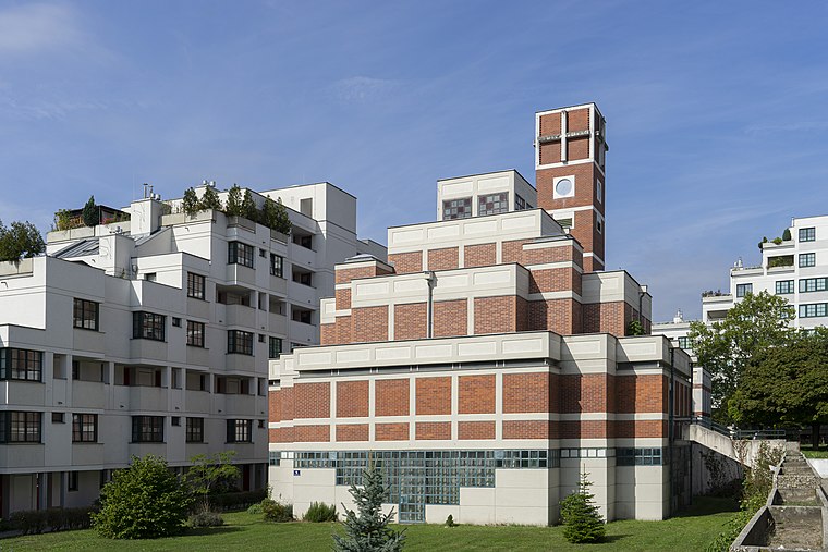
Photo: Thomas Ledl, CC BY-SA 4.0.
Am Schöpfwerk Church is a Roman Catholic parish church, dedicated to Saint Francis of Assisi, and is the most recently built church in Meidling, the 12th district of Vienna, Austria. Am Schöpfwerk Church is situated 530 metres southwest of Lainzer Tunnel Portal Inzersdorf.
Places in the Area
Nearby places include Am Schöpfwerk and Kabelwerk.


Lainzer Tunnel Portal Inzersdorf
- Type: Building
- Location: Meidling, Vienna, Austria, Central Europe, Europe
- View on OpenStreetMap
Latitude
48.16349° or 48° 9′ 49″ northLongitude
16.33206° or 16° 19′ 55″ eastOpen location code
8FWR587J+9ROpenStreetMap ID
way 655200639OpenStreetMap feature
building=service
This page is based on OpenStreetMap, Wikidata, and Wikimedia Commons.
We’d love your help improving our open data sources. Thank you for contributing.
Satellite Map
Discover Lainzer Tunnel Portal Inzersdorf from above in high-definition satellite imagery.
Notable Places Nearby
Highlights include Süd substation and Pottendorfer Steg.
Nearby Places
Explore places such as Lainzer Tunnel Portal Inzersdorf and Notausstieg Eibesbrunnergasse.
Vienna: Must-Visit Destinations
Delve into Innere Stadt, Vienna International Airport, Inner East, and Alsergrund.
Curious Buildings to Discover
Uncover intriguing buildings from every corner of the globe.
About Mapcarta. Data © OpenStreetMap contributors and available under the Open Database License". Text is available under the CC BY-SA 4.0 license, except for photos, directions, and the map. Photo: Jebulon, CC0.