DRK-Zentrum Fuhrmannshof
DRK-Zentrum Fuhrmannshof is a social service facility in Buxtehude, Stade, Lower Saxony which is located on Estebrügger Straße. DRK-Zentrum Fuhrmannshof is situated nearby to the mosque Selam Moschee - Islamische Gemeinde Buxtehude e. V., as well as near the bridge Hafenbrücke.| Tap on a place to explore it |
Places of Interest Nearby
Highlights include St.-Petri-Kirche and Marschtorzwinger.
St.-Petri-Kirche
Church
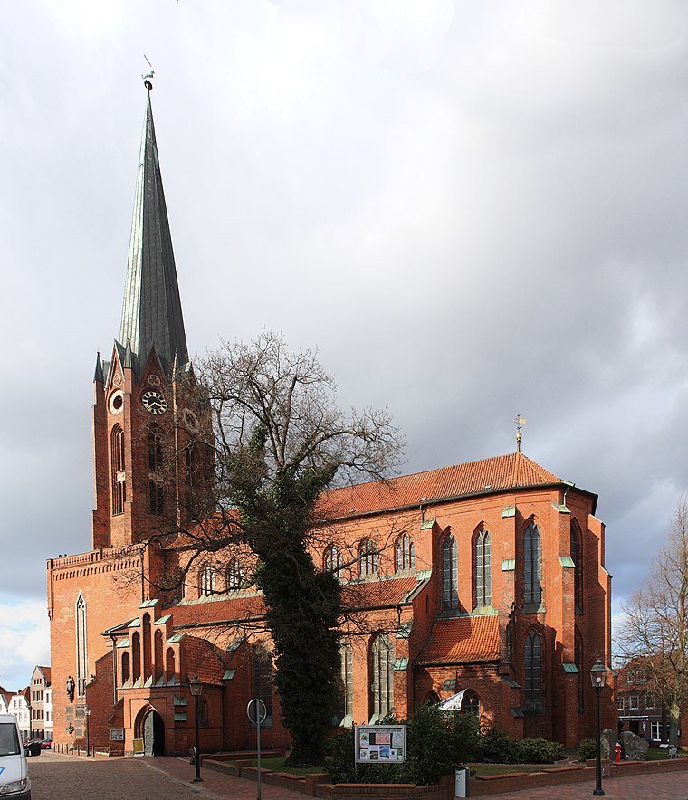
Photo: Knipptang, CC BY-SA 3.0.
St.-Petri-Kirche is a church, which is situated 360 metres south of DRK-Zentrum Fuhrmannshof.
Marschtorzwinger
Tower
 Marschtorzwinger is a tower, which is situated 230 metres south of DRK-Zentrum Fuhrmannshof.

Places in the Area
Nearby places include Dammhausen and Estebrügge.
Dammhausen
Suburb

Photo: Tadü, CC BY-SA 4.0.
Dammhausen is a suburb, which is situated 3 km northwest of DRK-Zentrum Fuhrmannshof.
Estebrügge
Village

Photo: Knipptang, CC BY-SA 3.0.
Estebrügge is a village, which is situated 4 km northeast of DRK-Zentrum Fuhrmannshof.
Neukloster
Suburb

Photo: Dkvtig, CC BY-SA 4.0.
Neukloster is a suburb, which is situated 4½ km west of DRK-Zentrum Fuhrmannshof.
DRK-Zentrum Fuhrmannshof
- Type: Social service facility
- Address: Estebrügger Straße 15, Buxtehude, 21614
- Category: building
- Location: Buxtehude, Stade, Elbe-Weser Triangle, Lower Saxony, Germany, Central Europe, Europe
- View on OpenStreetMap
Latitude
53.48042° or 53° 28′ 50″ northLongitude
9.70083° or 9° 42′ 3″ eastBrand
German Red CrossOpen location code
9F5FFPJ2+58OpenStreetMap ID
way 656334859OpenStreetMap feature
amenity=social_facilityOpenStreetMap feature
building=construction
This page is based on OpenStreetMap, Wikidata, and Wikimedia Commons.
We’d love your help improving our open data sources. Thank you for contributing.
Satellite Map
Discover DRK-Zentrum Fuhrmannshof from above in high-definition satellite imagery.
Notable Places Nearby
Highlights include Selam Moschee - Islamische Gemeinde Buxtehude e. V. and Hafenbrücke.
Nearby Places
Explore places such as Buxtehude, Esteanger and Rasa Sayang.
Elbe-Weser Triangle: Must-Visit Destinations
Delve into Bremerhaven, Cuxhaven, Stade, and Neuwerk.
Curious Social Service Facilities to Discover
Uncover intriguing social service facilities from every corner of the globe.
About Mapcarta. Data © OpenStreetMap contributors and available under the Open Database License". Text is available under the CC BY-SA 4.0 license, except for photos, directions, and the map. Photo: hh oldman, CC BY 3.0.