Konzentrationslager Loibl-Nord
Konzentrationslager Loibl-Nord is a memorial in Ferlach, Klagenfurt-Land District, Carinthia. Konzentrationslager Loibl-Nord is situated nearby to the ruins Matheus, as well as near the peak Polna peč.| Tap on a place to explore it |
Places of Interest Nearby
Highlights include Loibl Pass and Koča na Ljubelju.
Loibl Pass
Mountain saddle

Photo: Johann Jaritz, CC BY-SA 3.0 at.
The Loibl Pass or Ljubelj Pass is a high mountain pass in the Karawanks chain of the Southern Limestone Alps, linking Austria with Slovenia. The Loibl Pass road is the shortest connection between the Carinthian town of Ferlach and Tržič in Upper Carniola and part of the European route E652 from Klagenfurt to Naklo.
Koča na Ljubelju
Mountain hut

Photo: Johann Jaritz, CC BY-SA 3.0.
Koča na Ljubelju is a mountain hut, which is situated 1¼ km southeast of Konzentrationslager Loibl-Nord.
Loiblpass concentration camp - southern camp
Memorial
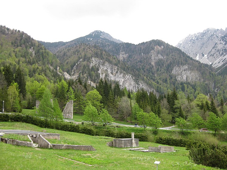
Photo: Sl-Ziga, Public domain.
Loiblpass concentration camp - southern camp is a memorial, which is situated 2 km southeast of Konzentrationslager Loibl-Nord.
Places in the Area
Nearby places include Podljubelj and Planina Ilovica.
Podljubelj
Village

Photo: Sl-Ziga, Public domain.
Podljubelj is a settlement on the road to the Ljubelj Pass in the Municipality of Tržič in the Upper Carniola region of Slovenia. Podljubelj is situated 6 km southeast of Konzentrationslager Loibl-Nord.
Planina Ilovica
Locality

Photo: Darcy Parks, CC BY-SA 2.0.
Planina Ilovica is a locality, which is situated 7 km east of Konzentrationslager Loibl-Nord.
Planina Šija
Locality

Photo: Darcy Parks, CC BY-SA 2.0.
Planina Šija is a locality, which is situated 7 km east of Konzentrationslager Loibl-Nord.
Konzentrationslager Loibl-Nord
- Type: Memorial
- Category: historic site
- Location: Ferlach, Klagenfurt-Land District, Carinthia, Austria, Central Europe, Europe
- View on OpenStreetMap
Latitude
46.44347° or 46° 26′ 37″ northLongitude
14.25155° or 14° 15′ 6″ eastOpen location code
8FRPC7V2+9JOpenStreetMap ID
way 661153008OpenStreetMap feature
historic=memorial
This page is based on OpenStreetMap, Wikidata, and Wikimedia Commons.
We’d love your help improving our open data sources. Thank you for contributing.
Satellite Map
Discover Konzentrationslager Loibl-Nord from above in high-definition satellite imagery.
Notable Places Nearby
Highlights include Matheus and Polna peč.
Nearby Places
Explore places such as Pamschbauer and Pamschbauer / Pamž.
Carinthia: Must-Visit Destinations
Delve into Klagenfurt, Villach, Wörthersee, and Spittal an der Drau.
Curious Memorials to Discover
Uncover intriguing memorials from every corner of the globe.
About Mapcarta. Data © OpenStreetMap contributors and available under the Open Database License". Text is available under the CC BY-SA 4.0 license, except for photos, directions, and the map. Photo: Wikimedia, CC BY-SA 3.0.