Collet de Grisella
Collet de Grisella is in Nice, Alpes-Maritimes, Provence-Alpes-Côte d’Azur. Collet de Grisella is situated nearby to the church Église Notre-Dame-du-Rosaire de Saint-Isidore, as well as near War memorial of Saint-Isidore.| Tap on a place to explore it |
Places of Interest Nearby
Highlights include Allianz Riviera and Musée National du Sport.
Allianz Riviera
Stadium
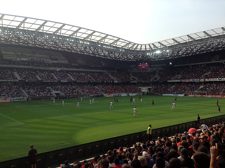
Photo: Mirasol, CC BY-SA 3.0.
Allianz Riviera is a multi-use stadium in Nice, France, used mostly for football matches of host OGC Nice and also for occasional home matches of rugby union club Toulon. Allianz Riviera is situated 1¼ km southwest of Collet de Grisella.
Musée National du Sport
Museum

Photo: Xavoun, CC BY-SA 3.0.
The Musée national du Sport is a national sports museum located in the Grand Stadium of Nice, France. The museum was first established in 1922 by the French minister of war, who held responsibility for sports. Musée National du Sport is situated 1 km southwest of Collet de Grisella.
Château de Crémat
Castle

Photo: Communicationchateaucremat, CC BY-SA 4.0.
Château de Crémat is a castle, which is situated 1¼ km northeast of Collet de Grisella.
Places in the Area
Nearby places include La Gaude and Saint-Laurent-du-Var.
La Gaude
Village

Photo: Ariadacapo, CC BY 4.0.
La Gaude is a commune in the Alpes-Maritimes department in southeastern France. La Gaude is situated 4½ km west of Collet de Grisella.
Saint-Laurent-du-Var
Town

Photo: HenrikKbh, CC BY-SA 3.0.
Saint-Laurent-du-Var is a commune in the Alpes-Maritimes department in the Provence-Alpes-Côte d'Azur region on the French Riviera. Saint-Laurent-du-Var is situated 5 km south of Collet de Grisella.
Colomars
Village

Photo: Jpchevreau, CC BY-SA 3.0.
Colomars is a commune in the Alpes-Maritimes département in the Provence-Alpes-Côte d'Azur region in southeastern France. Inhabitants of Colomars are called Colomarsois. Colomars is situated 6 km north of Collet de Grisella.
Collet de Grisella
- Type: Industry
- Location: Nice, Arrondissement of Nice, Alpes-Maritimes, Provence-Alpes-Côte d’Azur, France, Europe
- View on OpenStreetMap
Latitude
43.71276° or 43° 42′ 46″ northLongitude
7.20237° or 7° 12′ 9″ eastOpen location code
8FM9P672+4WOpenStreetMap ID
way 662909549OpenStreetMap feature
landuse=industrial
This page is based on OpenStreetMap, Wikidata, and Wikimedia Commons.
We’d love your help improving our open data sources. Thank you for contributing.
Satellite Map
Discover Collet de Grisella from above in high-definition satellite imagery.
Notable Places Nearby
Highlights include Collet de Grisella and Église Notre-Dame-du-Rosaire de Saint-Isidore.
Nearby Places
Explore places such as PAL and UPS.
Alpes-Maritimes: Must-Visit Destinations
Delve into Cannes, Antibes, Menton, and Grasse.
Curious Places to Discover
Uncover intriguing places from every corner of the globe.
About Mapcarta. Data © OpenStreetMap contributors and available under the Open Database License". Text is available under the CC BY-SA 4.0 license, except for photos, directions, and the map. Photo: Michaelphillipr, CC BY-SA 3.0.