Torre Garcini. espai municipal
Torre Garcini. espai municipal is a farmhouse in Sant Martí, Barcelona, Catalonia. Torre Garcini. espai municipal is situated nearby to the park Plaça de Rosa Galobardes i Alsina, as well as near the community center Casal de Joves Girapells.| Tap on a place to explore it |
Places of Interest Nearby
Highlights include Hospital de Sant Pau and Mercat del Guinardó.
Hospital de Sant Pau
Hospital

Photo: Matinibz, CC BY-SA 3.0.
The former Hospital de la Santa Creu i Sant Pau in the neighborhood of El Guinardó, Barcelona, Catalonia, Spain, is a complex built between 1901 and 1930. Hospital de Sant Pau is situated 550 metres southwest of Torre Garcini. espai municipal.
Mercat del Guinardó
Marketplace

Photo: Herodotptlomeu, CC BY-SA 4.0.
Mercat del Guinardó is a marketplace, which is situated 140 metres northwest of Torre Garcini. espai municipal.
Biblioteca Camp de l’Arpa-Caterina Albert
Library
 Biblioteca Camp de l’Arpa-Caterina Albert is a library, which is situated 330 metres southeast of Torre Garcini. espai municipal.
Places in the Area
Nearby places include El Guinardó and El Camp de l’Arpa del Clot.
El Guinardó
Quarter
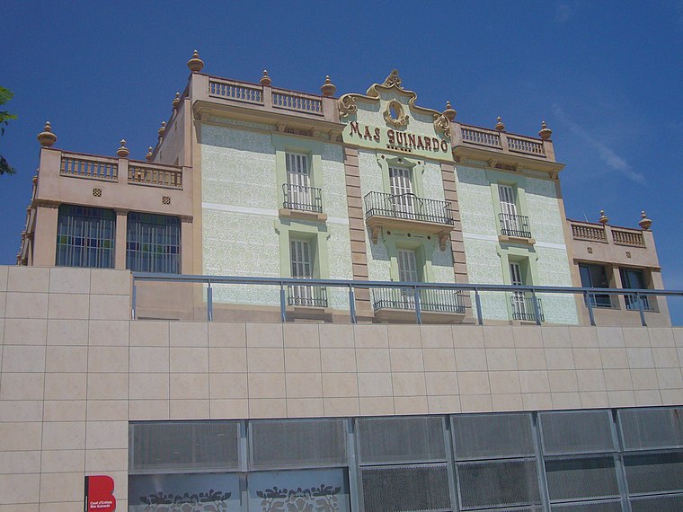
Photo: Jordiferrer, CC BY-SA 3.0.
El Guinardó is a neighborhood in the Horta-Guinardó district of Barcelona. El Guinardó is a neighborhood nestled within the old municipality of Sant Martí de Provençals, straddling the border between Horta — with which it once shared some land — and Gràcia.
El Camp de l’Arpa del Clot
Neighborhood

Photo: Mutari, Public domain.
El Camp de l'Arpa del Clot is one of the ten neighborhoods of Barcelona which compose the district of Sant Martí, Catalonia. It was annexed by Barcelona in the year 1897. It is situated in the upper part of this district and before it was named Camp de l'Arca.

Torre Garcini. espai municipal
- Type: Farmhouse
- Categories: building, historic site, and agriculture
- Location: Sant Martí, Barcelona, Barcelona, Catalonia, Eastern Spain, Spain, Iberia, Europe
- View on OpenStreetMap
Latitude
41.41821° or 41° 25′ 6″ northLongitude
2.17939° or 2° 10′ 46″ eastLevels
4Open location code
8FH4C59H+7QOpenStreetMap ID
way 663178339OpenStreetMap feature
building=farmOpenStreetMap feature
historic=yes
This page is based on OpenStreetMap, Wikidata, and Wikimedia Commons.
We’d love your help improving our open data sources. Thank you for contributing.
Satellite Map
Discover Torre Garcini. espai municipal from above in high-definition satellite imagery.
Notable Places Nearby
Highlights include Plaça de Rosa Galobardes i Alsina and Casal de Joves Girapells.
Nearby Places
Explore places such as Xiprer - Vinya and Rodanet Marketing Interactivo.
Barcelona: Must-Visit Destinations
Delve into Ciutat Vella, Eixample, Gràcia, and Sants-Montjuïc.
Curious Farmhouses to Discover
Uncover intriguing farmhouses from every corner of the globe.
About Mapcarta. Data © OpenStreetMap contributors and available under the Open Database License". Text is available under the CC BY-SA 4.0 license, except for photos, directions, and the map. Photo: phyrephox, CC BY-SA 2.0.