Feuerwehr Schwarzbach
Feuerwehr Schwarzbach is a fire station in Schwarzbach, Oberspreewald-Lausitz, Brandenburg which is located on Friedensstraße. Feuerwehr Schwarzbach is situated nearby to Weinbergsteich, as well as near Mittelteich.| Tap on a place to explore it |
- Type: Fire station
- Address: Friedensstraße 1a, Schwarzbach, 01945
- Roof shape: gabled
Places of Interest Nearby
Highlights include Sorgenteich and Aussichtsturm Bucksche Schweiz.
Sorgenteich
Protected area
 Sorgenteich is a protected area, which is situated 2½ km southwest of Feuerwehr Schwarzbach.
Aussichtsturm Bucksche Schweiz
Scenic viewpoint

Photo: PaulT, CC BY-SA 4.0.
Aussichtsturm Bucksche Schweiz is a scenic viewpoint, which is situated 4 km southeast of Feuerwehr Schwarzbach.

Places in the Area
Nearby places include Guteborn and Biehlen.
Guteborn
Village
 Guteborn is a municipality in the Oberspreewald-Lausitz district of Upper Lusatia, Brandenburg, Germany. Guteborn is situated 3 km south of Feuerwehr Schwarzbach.

Peickwitz
Village
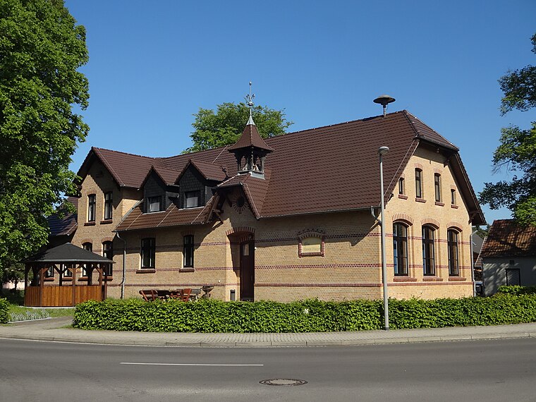
Photo: Z thomas, CC BY-SA 4.0.
Peickwitz is a village, which is situated 4 km northeast of Feuerwehr Schwarzbach.
Feuerwehr Schwarzbach
- Category: building
- Location: Schwarzbach, Oberspreewald-Lausitz, Brandenburg, Germany, Central Europe, Europe
- View on OpenStreetMap
Latitude
51.44934° or 51° 26′ 58″ northLongitude
13.93306° or 13° 55′ 59″ eastOpen location code
9F3MCWXM+P6OpenStreetMap ID
way 672468757OpenStreetMap feature
amenity=fire_stationOpenStreetMap feature
building=yesOpenStreetMap attribute
roof-shape=gabled
This page is based on OpenStreetMap, Wikidata, and Wikimedia Commons.
We’d love your help improving our open data sources. Thank you for contributing.
Satellite Map
Discover Feuerwehr Schwarzbach from above in high-definition satellite imagery.
Notable Places Nearby
Highlights include Reitplatz Schwarzbach and Nowatschteich.
Nearby Places
Explore places such as Axels Gasthof and Tischlerei Udo Herrmann.
Brandenburg: Must-Visit Destinations
Delve into Potsdam, Cottbus, Frankfurt an der Oder, and Brandenburg an der Havel.
Curious Fire Stations to Discover
Uncover intriguing fire stations from every corner of the globe.
About Mapcarta. Data © OpenStreetMap contributors and available under the Open Database License". Text is available under the CC BY-SA 4.0 license, except for photos, directions, and the map. Photo: Leviathan1983, CC BY-SA 3.0.