Park Pond
Park Pond is a pond in Town of Waterbury, Naugatuck Valley Planning Region, Connecticut. Park Pond is situated nearby to the fire station Waterbury Fire Department Station 1, as well as near the reservoir Belleview Lake.| Tap on a place to explore it |
Places of Interest Nearby
Highlights include Beth El Synagogue and Mattatuck Museum.
Beth El Synagogue
Synagogue

Photo: Magicpiano, CC BY-SA 4.0.
Beth El Synagogue is a historic synagogue at 359–375 Cooke Street in Waterbury, Connecticut. Built in 1929, it is the first synagogue in the state to be built in the Byzantine Revival style, and was listed on the National Register of Historic Places in 1995 for its architecture. Beth El Synagogue is situated 1 mile southwest of Park Pond.
Mattatuck Museum
Museum

Photo: Jllm06, CC BY-SA 4.0.
The Mattatuck Museum is a cultural institution based in Waterbury, Connecticut, USA. The museum's displays include the history, industries and culture of Waterbury and the Central Naugatuck Valley area, and art, including works about the state's history, people and scenery, and works of artists from Connecticut. Mattatuck Museum is situated 1½ miles southwest of Park Pond.
Basilica of the Immaculate Conception
Church

Photo: Twb116, CC BY-SA 3.0.
The Basilica of the Immaculate Conception is a Roman Catholic church located at 74 West Main Street in Waterbury, Connecticut. Basilica of the Immaculate Conception is situated 1½ miles southwest of Park Pond.
Places in the Area
Nearby places include Hillside Historic District and Waterville.
Hillside Historic District
Neighborhood

Photo: Magicpiano, CC BY-SA 4.0.
The Hillside Historic District in Waterbury, Connecticut is a 106-acre historic district that was listed on the National Register of Historic Places in 1987.
Waterville
Hamlet
Waterville is a neighborhood of the city of Waterbury, Connecticut. It was formerly known as Pine Hole and Haydensville. It has been home to industrial and manufacturing facilities from the 1960s onward. Waterville is situated 1½ miles northwest of Park Pond.
Bank Street Historic District
Neighborhood
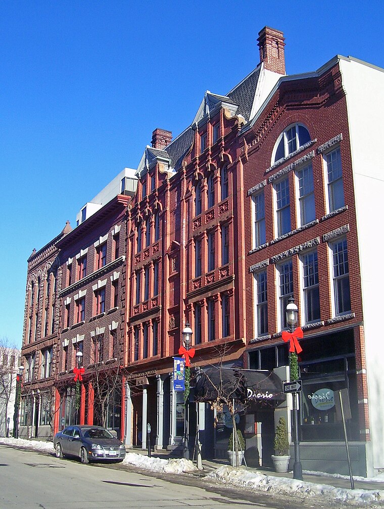
Photo: Daniel Case, CC BY-SA 3.0.
The Bank Street Historic District is a group of four attached brick commercial buildings in different architectural styles on that street in Waterbury, Connecticut, United States. Bank Street Historic District is situated 1½ miles southwest of Park Pond.
Park Pond
- Type: Pond
- Category: body of water
- Location: Town of Waterbury, Naugatuck Valley Planning Region, Connecticut, New England, United States, North America
- View on OpenStreetMap
Latitude
41.57686° or 41° 34′ 37″ northLongitude
-73.02544° or 73° 1′ 32″ westOpen location code
87H8HXGF+PROpenStreetMap ID
way 678335078OpenStreetMap feature
natural=waterOpenStreetMap feature
water=pond
This page is based on OpenStreetMap, Wikidata, and Wikimedia Commons.
We’d love your help improving our open data sources. Thank you for contributing.
Satellite Map
Discover Park Pond from above in high-definition satellite imagery.
Places with the Same Name
Discover other places named “Park Pond”.
Notable Places Nearby
Highlights include Waterbury Fire Department Station 1 and Belleview Lake.
Nearby Places
Explore places such as North Main & Lakewood and Truman Apartments.
Connecticut: Must-Visit Destinations
Delve into Hartford, New Haven, Bridgeport, and Stamford.
Curious Ponds to Discover
Uncover intriguing ponds from every corner of the globe.
About Mapcarta. Data © OpenStreetMap contributors and available under the Open Database License". Text is available under the CC BY-SA 4.0 license, except for photos, directions, and the map. Photo: Wikimedia, CC0.