Trafostation Halten
Trafostation Halten is a building in Meilen, Canton of Zurich. Trafostation Halten is situated nearby to the waterfall Beugenbach-Wasserfall V, as well as near the playground Splielplatz Kindergarten Just.| Tap on a place to explore it |
Places of Interest Nearby
Highlights include Meilen railway station and Meilen–Rorenhaab.
Meilen railway station
Railway station

Photo: Paebi, CC BY-SA 3.0.
Meilen is a railway station in the Swiss canton of Zurich, situated in the municipality of Meilen on the eastern shore of Lake Zurich. The station is located on the Lake Zurich right bank railway line, within fare zone 141 of the Zürcher Verkehrsverbund. Meilen railway station is situated 1 km west of Trafostation Halten.
Meilen–Rorenhaab
Archaeological site

Photo: Roland zh, CC BY-SA 3.0.
Meilen–Rorenhaab is one of the 111 serial sites of the UNESCO World Heritage Site Prehistoric pile dwellings around the Alps, of which 56 are located in Switzerland. Meilen–Rorenhaab is situated 1 km south of Trafostation Halten.
St. Martin
Church

Photo: Charly Bernasconi, CC BY-SA 4.0.
St. Martin is a church, which is situated 1 km west of Trafostation Halten.
Places in the Area
Nearby places include Meilen and Uetikon am See.
Meilen
Town
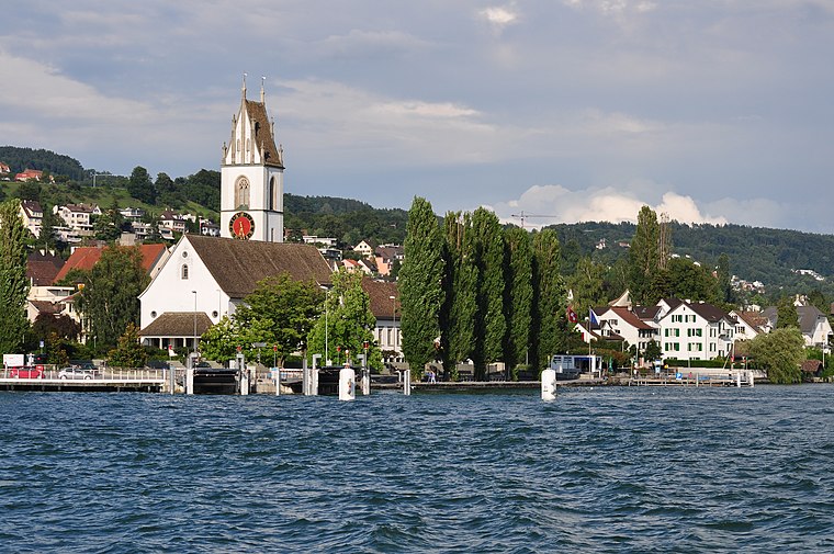
Photo: Roland zh, CC BY-SA 3.0.
Meilen is a municipality in the district of Meilen in the canton of Zürich in Switzerland.
Uetikon am See
Village

Photo: Iotatau, CC BY-SA 3.0.
Uetikon am See is a municipality in the district of Meilen in the canton of Zürich in Switzerland.
Feldmeilen
Village
Feldmeilen is a village within the municipality of Meilen in the Canton of Zürich in Switzerland. Feldmeilen is situated 3 km west of Trafostation Halten.
Trafostation Halten
- Type: Building
- Location: Meilen, Meilen District, Canton of Zurich, Switzerland, Central Europe, Europe
- View on OpenStreetMap
Latitude
47.27126° or 47° 16′ 17″ northLongitude
8.65788° or 8° 39′ 28″ eastOperator
EWM AGOpen location code
8FVC7MC5+G5OpenStreetMap ID
way 681463959OpenStreetMap feature
building=service
This page is based on OpenStreetMap, Wikidata, and Wikimedia Commons.
We’d love your help improving our open data sources. Thank you for contributing.
Satellite Map
Discover Trafostation Halten from above in high-definition satellite imagery.
Notable Places Nearby
Highlights include Beugenbach-Wasserfall V and Splielplatz Kindergarten Just.
Nearby Places
Explore places such as Meilen, Halten and Kids‘ Corner.
Switzerland: Must-Visit Destinations
Delve into Zurich, Berne, Geneva, and Basel.
Curious Buildings to Discover
Uncover intriguing buildings from every corner of the globe.
About Mapcarta. Data © OpenStreetMap contributors and available under the Open Database License". Text is available under the CC BY-SA 4.0 license, except for photos, directions, and the map. Photo: Roland zh, CC BY-SA 3.0.