Centre d’Interpretació del Parc Natural de la Serra de Mariola
Centre d’Interpretació del Parc Natural de la Serra de Mariola is a tourism office in Bocairent, Valencia, Valencian Community. Centre d’Interpretació del Parc Natural de la Serra de Mariola is situated nearby to Pinturas antiguas, as well as near the spring Font de la era.| Tap on a place to explore it |
- Email: serra_mariola@gva.es
- Type: Tourism office
- Also known as: “Centre d’Informació del Parc Natural de la Serra de Mariola”
Places of Interest Nearby
Highlights include Castle of Banyeres and Museo Valenciano del Papel.
Castle of Banyeres
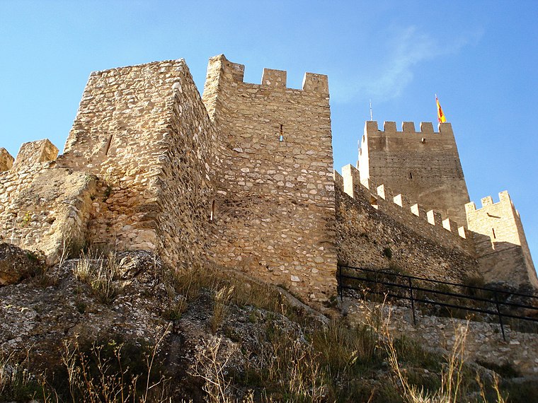
Photo: Qoan, CC BY-SA 3.0.
The castle of Banyeres, Valencian Community, is an Almohad fortress built in the 13th century, which is situated on the tossal de l'Àguila, English: 'Hill of the Eagle', in the geographical center of Banyeres, with an elevation of 830 meters above the sea level. Castle of Banyeres is situated 2½ km northwest of Centre d’Interpretació del Parc Natural de la Serra de Mariola.
Museo Valenciano del Papel
Museum
 Museo Valenciano del Papel is a museum, which is situated 3 km northwest of Centre d’Interpretació del Parc Natural de la Serra de Mariola.
Torre de la Font Bona
Museum
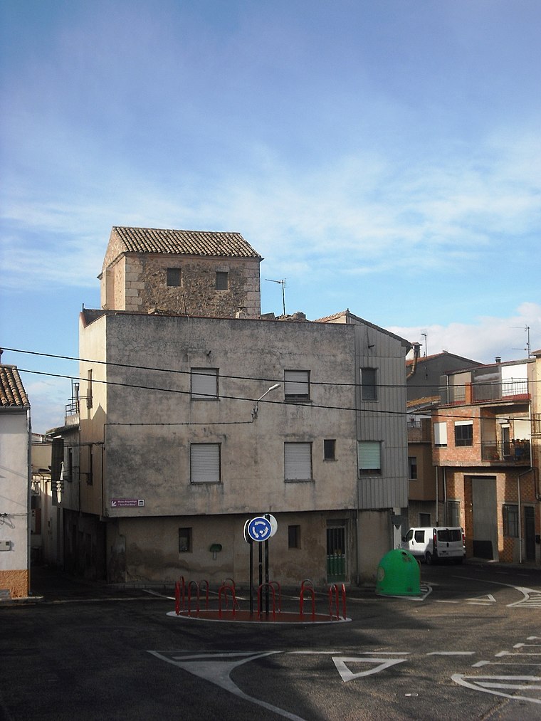
Photo: Qoan, CC BY-SA 3.0.
Torre de la Font Bona is a museum, which is situated 3 km northwest of Centre d’Interpretació del Parc Natural de la Serra de Mariola.
Places in the Area
Nearby places include Banyeres de Mariola and Bocairent.
Banyeres de Mariola
Village

Photo: Qoan, CC BY-SA 3.0.
Banyeres de Mariola, known simply as Banyeres, is a settlement and a municipality in the north of the province of Alicante, 860 metres above sea level, with a population of 7,500.
Bocairent
Village
Bocairent is a municipality in the comarca of Vall d'Albaida in the Valencian Community, Spain. Bocairent is situated 8 km north of Centre d’Interpretació del Parc Natural de la Serra de Mariola.
Onil
Town

Photo: Joanbanjo, CC BY-SA 4.0.
Onil is a town and municipality located in the comarca of L'Alcoià, in the province of Alicante, Valencian Community, Spain. It has an area of 48.41 km. Onil is situated 8 km south of Centre d’Interpretació del Parc Natural de la Serra de Mariola.
Centre d’Interpretació del Parc Natural de la Serra de Mariola
- Categories: information, building, and tourism
- Location: Bocairent, Valencia, Valencian Community, Eastern Spain, Spain, Iberia, Europe
- View on OpenStreetMap
Latitude
38.69898° or 38° 41′ 56″ northLongitude
-0.63947° or 0° 38′ 22″ westOpen location code
8CCXM9X6+H6OpenStreetMap ID
way 689601810OpenStreetMap feature
building=yesOpenStreetMap feature
tourism=information
This page is based on OpenStreetMap, Wikidata, and Wikimedia Commons.
We’d love your help improving our open data sources. Thank you for contributing.
Satellite Map
Discover Centre d’Interpretació del Parc Natural de la Serra de Mariola from above in high-definition satellite imagery.
In Other Languages
From Catalan to Spanish—“Centre d’Interpretació del Parc Natural de la Serra de Mariola” goes by many names.
- Catalan: “Centre d’Interpretació del Parc Natural de la Serra de Mariola”
- Spanish: “Centro de Interpretación del Parque Natural de la Sierra de Mariola”
Notable Places Nearby
Highlights include Pinturas antiguas and Font de la era.
Nearby Places
Explore places such as Youth Hostel Ull de Canals and els Ansarins.
Valencia: Must-Visit Destinations
Delve into Valencia, Sagunto, Gandía, and Xàtiva.
Curious Tourism Offices to Discover
Uncover intriguing tourism offices from every corner of the globe.
About Mapcarta. Data © OpenStreetMap contributors and available under the Open Database License". Text is available under the CC BY-SA 4.0 license, except for photos, directions, and the map. Photo: andruby, CC BY 2.0.