Relais Franco-Suisse Renault
Relais Franco-Suisse Renault is a building in Crolles, Arrondissement of Grenoble, Auvergne-Rhône-Alpes which is located on Avenue de la Résistance. Relais Franco-Suisse Renault is situated nearby to the library Médiathèque Gilbert Dallet, as well as near the school École primaire La Cascade.| Tap on a place to explore it |
Places of Interest Nearby
Highlights include Église Saints-Pierre-et-Paul de Crolles and Château de Crolles.
Église Saints-Pierre-et-Paul de Crolles
Church

Photo: CORLIN, CC BY-SA 4.0.
Église Saints-Pierre-et-Paul de Crolles is a church, which is situated 300 metres northeast of Relais Franco-Suisse Renault.
Château de Crolles
Castle
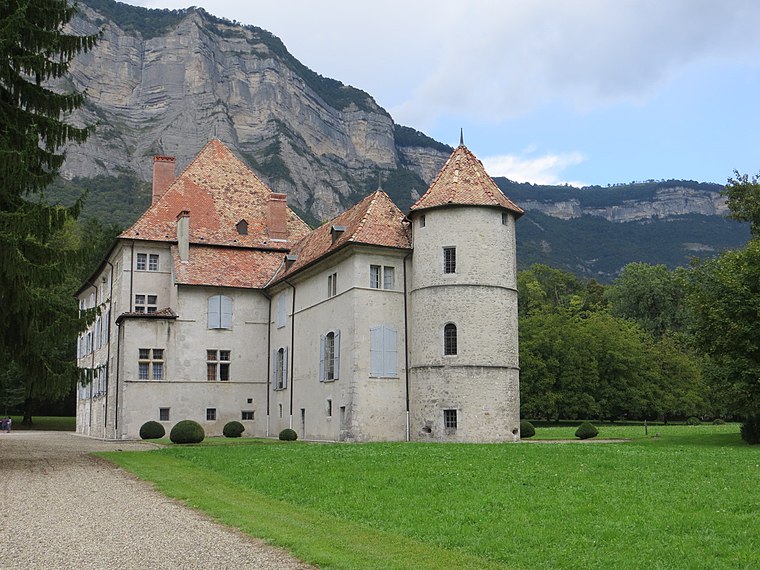
Photo: Rtome, CC BY-SA 3.0.
Château de Crolles is a castle, which is situated 520 metres east of Relais Franco-Suisse Renault.
Château de Montfort
Ruins

Photo: Patafisik, CC BY-SA 4.0.
Château de Montfort is a ruins, which is situated 2 km northeast of Relais Franco-Suisse Renault.
Places in the Area
Nearby places include Crolles and Bernin.
Crolles
Village

Photo: Wikimedia, CC BY-SA 3.0.
Crolles is a commune in the Isère department in southeastern France. It is located in the Isère valley, 20 km northeast of Grenoble, upstream on the river Isère. It has given its name to the Dent de Crolles mountain, which stands just above the city.
Bernin
Village

Photo: Patafisik, CC BY-SA 3.0.
Bernin is a commune in the Isère department in southeastern France.
Saint-Hilaire
Village

Photo: Boly38, Public domain.
Saint-Hilaire, also known as Saint-Hilaire-du-Touvet, is a former commune in the Isère department in the Auvergne-Rhône-Alpes region in Southeastern France. Saint-Hilaire is situated 2½ km north of Relais Franco-Suisse Renault.
Relais Franco-Suisse Renault
- Type: Building
- Address: 53 Avenue de la Résistance
- Location: Crolles, Arrondissement of Grenoble, Isère, Auvergne-Rhône-Alpes, France, Europe
- View on OpenStreetMap
Latitude
45.28518° or 45° 17′ 7″ northLongitude
5.88417° or 5° 53′ 3″ eastBrand
RenaultOperator
RenaultOpen location code
8FQ77VPM+3MOpenStreetMap ID
way 69107000OpenStreetMap feature
building=yes
This page is based on OpenStreetMap, Wikidata, and Wikimedia Commons.
We’d love your help improving our open data sources. Thank you for contributing.
Satellite Map
Discover Relais Franco-Suisse Renault from above in high-definition satellite imagery.
Notable Places Nearby
Highlights include Médiathèque Gilbert Dallet and École primaire La Cascade.
Nearby Places
Explore places such as Pharmacie Luu Duc and Storia Pizza.
Isère: Must-Visit Destinations
Delve into Grenoble, Vienne, Voiron, and Alpe d’Huez.
Curious Buildings to Discover
Uncover intriguing buildings from every corner of the globe.
About Mapcarta. Data © OpenStreetMap contributors and available under the Open Database License". Text is available under the CC BY-SA 4.0 license, except for photos, directions, and the map. Photo: Samat, CC BY-SA 3.0.