Peterburs
Peterburs is a farm in North Rhine-Westphalia, Germany. Peterburs is situated nearby to the museum Galerie im Mertenshof, as well as near Bänischsee.| Tap on a place to explore it |
Places of Interest Nearby
Highlights include Bänischsee and Tönnies-Arena.

Tönnies-Arena
Stadium

Photo: Bielibob, CC BY-SA 3.0.
Tönnies-Arena is a stadium, which is situated 1¼ km south of Peterburs.
Schloss Rheda
Castle
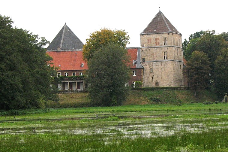
Photo: Jkl-foto, CC BY-SA 3.0.
Schloss Rheda is a castle, which is situated 3 km southwest of Peterburs.
Places in the Area
Nearby places include Rheda and Rheda-Wiedenbrück.
Rheda
Suburb

Photo: Wikimedia, CC BY-SA 3.0.
Rheda is a town in North Rhine-Westphalia, a part of the municipality of Rheda-Wiedenbrück in the Kreis of Gütersloh. Rheda is situated 3 km southwest of Peterburs.
Rheda-Wiedenbrück
Town

Photo: Wikimedia, CC BY-SA 3.0.
Rheda-Wiedenbrück is a city in the district of Gütersloh, in North Rhine-Westphalia, Germany. Rheda-Wiedenbrück is situated 3½ km south of Peterburs.

Peterburs
- Type: Farm
- Category: agriculture
- Location: North Rhine-Westphalia, Germany, Central Europe, Europe
- View on OpenStreetMap
Latitude
51.87224° or 51° 52′ 20″ northLongitude
8.31761° or 8° 19′ 3″ eastOpen location code
9F3CV8C9+V2OpenStreetMap ID
way 69683177OpenStreetMap feature
landuse=farmyard
This page is based on OpenStreetMap, Wikidata, and Wikimedia Commons.
We’d love your help improving our open data sources. Thank you for contributing.
Satellite Map
Discover Peterburs from above in high-definition satellite imagery.
Places with the Same Name
Discover other places named “Peterburs”.
Notable Places Nearby
Highlights include Galerie im Mertenshof and Schledebrücker Gräberfeld.
Nearby Places
Explore places such as Waldkindergarten and Hubertusheim.
North Rhine-Westphalia: Must-Visit Destinations
Delve into Cologne, Düsseldorf, Bonn, and Dortmund.
Curious Farms to Discover
Uncover intriguing farms from every corner of the globe.
About Mapcarta. Data © OpenStreetMap contributors and available under the Open Database License". Text is available under the CC BY-SA 4.0 license, except for photos, directions, and the map. Photo: Daniel Schwen, CC BY-SA 2.5.