Clairière aux Cabanes
Clairière aux Cabanes is a residential area in La Bresse, Arrondissement of Épinal, Grand Est. Clairière aux Cabanes is situated nearby to Bois des Lutins, as well as near Bol d’air.| Tap on a place to explore it |
Places of Interest Nearby
Highlights include Lac des Corbeaux and Col de Bramont.
Lac des Corbeaux
Fishing area
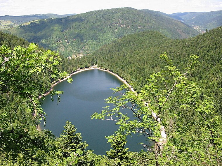
Photo: Cham, CC BY-SA 3.0.
Lac des Corbeaux is a lake near La Bresse, in Vosges, France. At an elevation of 900 metres, its surface area is 9.1 hectares. Lac des Corbeaux is situated 1¼ km southwest of Clairière aux Cabanes.

Réserve naturelle nationale de la tourbière de Machais
Nature reserve

Photo: Vosagus, CC BY-SA 3.0.
Réserve naturelle nationale de la tourbière de Machais is a nature reserve, which is situated 3 km east of Clairière aux Cabanes.
Places in the Area
Nearby places include Gérardmer and Xonrupt-Longemer.
Gérardmer
Town

Photo: Christophe.Finot, CC BY-SA 3.0.
Gérardmer is a commune in the Vosges Department, Grand Est, France. It is nicknamed "La perle des Vosges". Gérardmer is said to owe its name to Gerard, Duke of Lorraine, who in the 11th century built a tower on the bank of the lake or mer, near which, in 1285, a new town was founded. Gérardmer is situated 8 km north of Clairière aux Cabanes.
Xonrupt-Longemer
Village
 Xonrupt-Longemer is a commune in the Vosges department in Grand Est in northeastern France. Xonrupt-Longemer is situated 9 km north of Clairière aux Cabanes.
Clairière aux Cabanes
- Email: contact@bol-d-air.fr
- Type: Residential area
- Location: La Bresse, Arrondissement of Épinal, Vosges, Grand Est, France, Europe
- View on OpenStreetMap
Latitude
47.99941° or 47° 59′ 58″ northLongitude
6.91582° or 6° 54′ 57″ eastOperator
Bol d’Air ÉvasionOpen location code
8FV8XWX8+Q8OpenStreetMap ID
way 702507523OpenStreetMap feature
landuse=residential
This page is based on OpenStreetMap, Wikidata, and Wikimedia Commons.
We’d love your help improving our open data sources. Thank you for contributing.
Satellite Map
Discover Clairière aux Cabanes from above in high-definition satellite imagery.
Notable Places Nearby
Highlights include Bois des Lutins and Parc des Aventuriers.
Nearby Places
Explore places such as La Tribu Perchée and Cabane du Pêcheur.
Grand Est: Must-Visit Destinations
Delve into Strasbourg, Reims, Metz, and Nancy.
Curious Residential Areas to Discover
Uncover intriguing residential areas from every corner of the globe.
About Mapcarta. Data © OpenStreetMap contributors and available under the Open Database License". Text is available under the CC BY-SA 4.0 license, except for photos, directions, and the map. Photo: Florival fr, CC BY-SA 3.0.