Sundlaugin á Drangsnesi
Sundlaugin á Drangsnesi is a sports venue in Kaldrananeshreppur, Westfjords. Sundlaugin á Drangsnesi is situated nearby to the cliff Kerling, as well as near Malarhorn lighthouse.| Tap on a place to explore it |
Places of Interest Nearby
Highlights include Malarhorn lighthouse.
Malarhorn lighthouse
Lighthouse
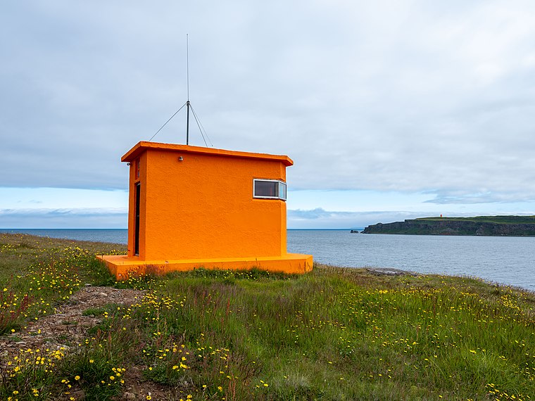
Photo: Bjorn.thorvaldsson.is, CC BY-SA 4.0.
Malarhorn lighthouse is situated 120 metres northeast of Sundlaugin á Drangsnesi.
Places in the Area
Nearby places include Drangsnes.
Drangsnes
Village

Photo: Wikimedia, CC BY-SA 3.0.
Drangsnes is a small town in the western part of Iceland, at the mouth of Steingrímsfjörður and near Hólmavík. It is part of the Kaldrananeshreppur municipality and only has 67 inhabitants.
Sundlaugin á Drangsnesi
- Type: Sports venue
- Categories: swimming, recreation area, and sports location
- Location: Kaldrananeshreppur, Westfjords, Iceland, Nordic countries, Europe
- View on OpenStreetMap
Latitude
65.68925° or 65° 41′ 21″ northLongitude
-21.43745° or 21° 26′ 15″ westOpen location code
99QWMHQ7+M2OpenStreetMap ID
way 707208625OpenStreetMap feature
leisure=sports_centreOpenStreetMap feature
sport=swimming
This page is based on OpenStreetMap, Wikidata, and Wikimedia Commons.
We’d love your help improving our open data sources. Thank you for contributing.
Satellite Map
Discover Sundlaugin á Drangsnesi from above in high-definition satellite imagery.
Notable Places Nearby
Highlights include Kerling and Drangsnes Hot Pots.
Nearby Places
Explore places such as Guesthouse Malarhorn and Malarhorn.
Westfjords: Must-Visit Destinations
Delve into Ísafjörður, Súðavík, and Suðureyri.
Curious Sports Venues to Discover
Uncover intriguing sports venues from every corner of the globe.
About Mapcarta. Data © OpenStreetMap contributors and available under the Open Database License". Text is available under the CC BY-SA 4.0 license, except for photos, directions, and the map. Photo: Danapit, CC BY-SA 3.0.