Cond. Roble Sabana
Cond. Roble Sabana is a residential area in Escazú, San José Province. Cond. Roble Sabana is situated nearby to the government office Interamericano para la Asistencia Democrática y Electoral, as well as near the dog park Parque de perros Rosalinda.| Tap on a place to explore it |
Places of Interest Nearby
Highlights include Tobías Bolaños International Airport and Hospital CIMA.
Tobías Bolaños International Airport
Aerodrome
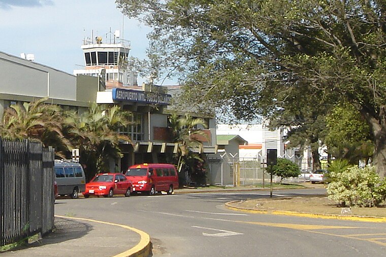
Photo: Mariordo, CC BY-SA 3.0.
Tobías Bolaños International Airport is one of four international airports in Costa Rica, and the secondary airport serving the city of San José, after Juan Santamaría International Airport. Tobías Bolaños International Airport is situated 4 km northeast of Cond. Roble Sabana.
Hospital CIMA
Hospital
Hospital CIMA San Jose is a hospital in San José, Costa Rica. The hospital opened in 2000. Hospital CIMA is a tertiary level, acute care hospital. It has an installed capacity of 103 beds. Hospital CIMA is situated 2 km northeast of Cond. Roble Sabana.
Estadio Nicolás Macís
Stadium

Photo: 7C7, CC BY-SA 4.0.
Estadio Nicolás Macís is a stadium, which is situated 2 km southeast of Cond. Roble Sabana.
Places in the Area
Nearby places include Escazú and San Antonio District, Escazú.
Escazú
Town

Photo: Armando Maynez, CC BY 2.0.
Escazú is a district of the Escazú canton, in the San José province of Costa Rica.
San Antonio District, Escazú
Village
San Antonio is a district of the Escazú canton, in the San José province of Costa Rica. San Antonio District, Escazú is situated 3 km southeast of Cond. Roble Sabana.
Santa Ana
Town

Photo: Gabriel P Chacon, CC BY-SA 3.0.
Santa Ana is a district and head city of the Santa Ana canton, in the San José province of Costa Rica. The city acts as seat to the municipal government of the Santa Ana Canton. Santa Ana is situated 3 km west of Cond. Roble Sabana.
Cond. Roble Sabana
- Type: Residential area
- Location: Escazú, San José Province, Costa Rica, Central America, North America
- View on OpenStreetMap
Latitude
9.9249° or 9° 55′ 30″ northLongitude
-84.15425° or 84° 9′ 15″ westOpen location code
66XQWRFW+X8OpenStreetMap ID
way 707360977OpenStreetMap feature
landuse=residential
This page is based on OpenStreetMap, Wikidata, and Wikimedia Commons.
We’d love your help improving our open data sources. Thank you for contributing.
Satellite Map
Discover Cond. Roble Sabana from above in high-definition satellite imagery.
Places with the Same Name
Discover other places named “Cond. Roble Sabana”.
Notable Places Nearby
Highlights include Interamericano para la Asistencia Democrática y Electoral and Parque de perros Rosalinda.
Nearby Places
Explore places such as Edificio Panorama 270 and Cons. Hacienda El Poró.
Costa Rica: Must-Visit Destinations
Delve into San José, Alajuela, Puerto Limón, and Liberia.
Curious Residential Areas to Discover
Uncover intriguing residential areas from every corner of the globe.
About Mapcarta. Data © OpenStreetMap contributors and available under the Open Database License". Text is available under the CC BY-SA 4.0 license, except for photos, directions, and the map. Photo: Andy Rusch, CC BY 2.0.