L’Île Roche
L’Île Roche is a commercial area in Sallanches, Arrondissement of Bonneville, Auvergne-Rhône-Alpes which is located on Clos de l’Île Roche. L’Île Roche is situated nearby to the shopping center Le Warens, as well as near the public building Centre des finances publiques.| Tap on a place to explore it |
Places of Interest Nearby
Highlights include Chapelle-école Saint-François-de-Sales de la Pierre de Sallanches and Town hall of Sallanches.
Chapelle-école Saint-François-de-Sales de la Pierre de Sallanches
Chapel
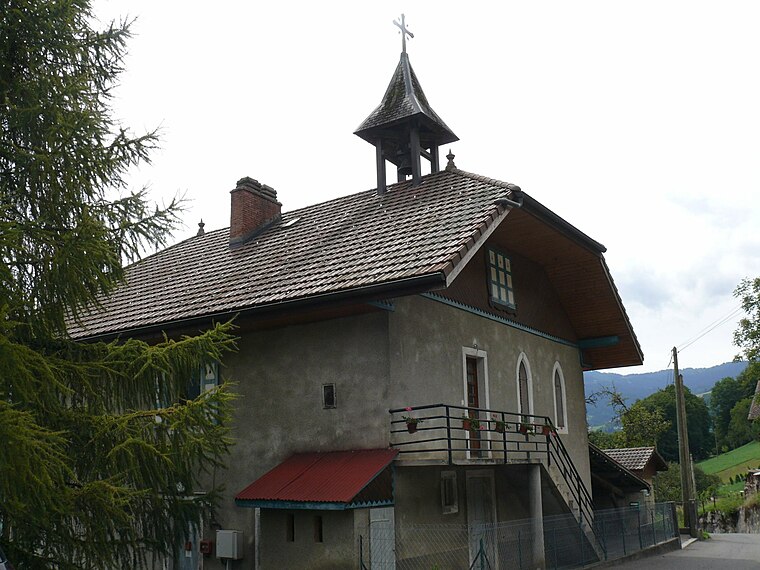
Photo: Peter17, CC BY-SA 4.0.
Chapelle-école Saint-François-de-Sales de la Pierre de Sallanches is situated 1¼ km southwest of L’Île Roche.
Town hall of Sallanches
Town hall

Photo: Ville de Sallanches, CC BY-SA 4.0.
Town hall of Sallanches is situated 2 km south of L’Île Roche.
Sallanches Aerodrome
Sallanches Aerodrome or Sallanches Mont-Blanc Aerodrome, formerly IATA: XSN, ICAO: LFHZ, was an airport in Sallanches, a commune in Haute-Savoie, France. It was permanently closed on 1 September 2020. Sallanches Aerodrome is situated 1 km southeast of L’Île Roche.Places in the Area
Nearby places include Sallanches and Oëx.
Sallanches
Town

Photo: Ville de Sallanches, CC BY-SA 4.0.
Sallanches is a commune in the Haute-Savoie department of the Auvergne-Rhône-Alpes region of France. Located close to the Mont Blanc massif, many visitors pass through the town en route to well-known alpine resorts such as Chamonix, Megève and Saint-Gervais-les-Bains.
Oëx
Hamlet
Oëx is a village in the Rhône-Alpes region of France, below Pointe d'Areu in the Arve valley. It is part of the commune Magland in Haute-Savoie department. Oëx is situated 4 km north of L’Île Roche.
Cordon
Village

Photo: ColdEel, CC BY-SA 3.0.
Cordon is a commune in the Haute-Savoie department in the Auvergne-Rhône-Alpes region in south-eastern France. It is part of the urban area of Sallanches. Cordon is situated 4 km south of L’Île Roche.
L’Île Roche
- Type: Commercial area
- Address: Clos de l’Île Roche, Sallanches, 74700
- Location: Sallanches, Arrondissement of Bonneville, Haute-Savoie, Auvergne-Rhône-Alpes, France, Europe
- View on OpenStreetMap
Latitude
45.95422° or 45° 57′ 15″ northLongitude
6.62795° or 6° 37′ 41″ eastOpen location code
8FQ8XJ3H+M5OpenStreetMap ID
way 708490618OpenStreetMap feature
landuse=retail
This page is based on OpenStreetMap, Wikidata, and Wikimedia Commons.
We’d love your help improving our open data sources. Thank you for contributing.
Satellite Map
Discover L’Île Roche from above in high-definition satellite imagery.
Notable Places Nearby
Highlights include Le Warens and Centre des finances publiques.
Nearby Places
Explore places such as Fnac and Maxi Zoo.
Haute-Savoie: Must-Visit Destinations
Delve into Chamonix, Annecy, Annemasse, and Evian.
Curious Commercial Areas to Discover
Uncover intriguing commercial areas from every corner of the globe.
About Mapcarta. Data © OpenStreetMap contributors and available under the Open Database License". Text is available under the CC BY-SA 4.0 license, except for photos, directions, and the map. Photo: Ypsilon from Finland, CC0.