Social Security Administration
Social Security Administration is a government office in Lynchburg, Central Virginia, Virginia which is located on Timberlake Road. Social Security Administration is situated nearby to Crosspoint Church, as well as near Dynamic Gymnastics.| Tap on a place to explore it |
Places of Interest Nearby
Highlights include Lynchburg Regional Airport and Samuel Miller House.
Lynchburg Regional Airport
Aerodrome

Photo: Patriarca12, CC BY-SA 4.0.
Lynchburg Regional Airport, also known as Preston Glenn Field, is a public use airport in Campbell County, Virginia, United States. It is located at the intersection of Route 29 South and Route 460, five nautical miles southwest of the central business district of the City of Lynchburg, which owns the airport. Lynchburg Regional Airport is situated 2½ miles south of Social Security Administration.
Samuel Miller House
House

Photo: Pubdog, Public domain.
The Samuel Miller House is a historic home located at Lynchburg, Virginia, United States. It is associated with Samuel Miller, a successful businessman and investor who was among the wealthiest men in the South during the years preceding the American Civil War. Samuel Miller House is situated 1 mile northeast of Social Security Administration.
Brookville High School
School building
Brookville High School is a high school in Campbell County, Virginia, United States. The school was founded in 1926 with the first elementary classes beginning in November. Brookville High School is situated 1 mile southwest of Social Security Administration.
Places in the Area
Nearby places include Timberlake and Forest.
Timberlake
Town
Timberlake is a census-designated place in Campbell County, Virginia, United States. The population was 13,267 at the 2020 census. It is part of the Lynchburg Metropolitan Statistical Area. Timberlake is situated 2 miles southwest of Social Security Administration.
Forest
Town

Photo: Warfieldian, CC BY-SA 3.0.
Forest is a census-designated place in eastern Bedford County, Virginia, United States. The population was 11,709 at the 2020 census. It is part of the Lynchburg Metropolitan Statistical Area. Forest is situated 4 miles west of Social Security Administration.
Kemper Street Industrial Historic District
Neighborhood
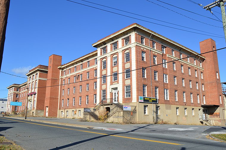
Photo: Nyttend, Public domain.
The Kemper Street Industrial Historic District encompasses a collection of industrial sites on Campbell Avenue and Kemper Street in Lynchburg, Virginia. Kemper Street Industrial Historic District is situated 5 miles northeast of Social Security Administration.
Social Security Administration
- Type: Government office
- Address: 7618 Timberlake Road, Lynchburg, VA 24502
- Categories: building, office, and government building
- Location: Lynchburg, Central Virginia, Virginia, South, United States, North America
- View on OpenStreetMap
Latitude
37.35479° or 37° 21′ 17″ northLongitude
-79.22143° or 79° 13′ 17″ westOperator
Social Security AdministrationOpen location code
87929Q3H+WCOpenStreetMap ID
way 709687052OpenStreetMap feature
building=yesOpenStreetMap feature
office=government
This page is based on OpenStreetMap, Wikidata, and Wikimedia Commons.
We’d love your help improving our open data sources. Thank you for contributing.
Satellite Map
Discover Social Security Administration from above in high-definition satellite imagery.
Places with the Same Name
Discover other places named “Social Security Administration”.
Notable Places Nearby
Highlights include Crosspoint Church and Dynamic Gymnastics.
Nearby Places
Explore places such as Timberlake Rd. (Social Security Office Parking Lot) and Timberlake Rd. (The Vistas Apartments, Across From Roundelay Rd.).
Central Virginia: Must-Visit Destinations
Delve into Richmond, Charlottesville, Petersburg, and Danville.
Curious Government Offices to Discover
Uncover intriguing government offices from every corner of the globe.
About Mapcarta. Data © OpenStreetMap contributors and available under the Open Database License". Text is available under the CC BY-SA 4.0 license, except for photos, directions, and the map. Photo: Wikimedia, CC0.