Kayak Tudense
Kayak Tudense is a building in Tui, Pontevedra, Galicia. Kayak Tudense is situated nearby to Boat Tour Tui - Rio Miño, as well as near the pitch Pista Polideportiva do Penedo.| Tap on a place to explore it |
Places of Interest Nearby
Highlights include Tui town hall and Igreja Paroquial de Valença.
Tui town hall
Town hall

Photo: Vivaelcelta, CC BY-SA 4.0.
Tui town hall is situated 710 metres north of Kayak Tudense.
Igreja Paroquial de Valença
Church

Photo: Daniel VILLAFRUELA, CC BY-SA 4.0.
Igreja Paroquial de Valença is a church, which is situated 1 km south of Kayak Tudense.
Fortificações da Praça de Valença do Minho
Historic site
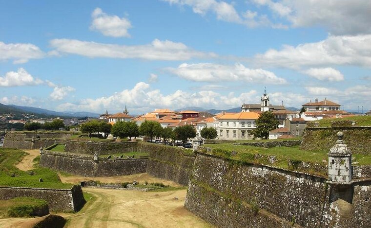
Photo: PQ3, CC BY-SA 3.0.
Fortificações da Praça de Valença do Minho is a historic site, which is situated 1 km south of Kayak Tudense.
Places in the Area
Nearby places include Valença and San Bartolomeu.
Valença

Photo: Sergei Gussev, CC BY 2.0.
Valença, also known as Valença do Minho, is a town and municipality in Portugal's Minho region. The town itself has 6,500 inhabitants. Valença lies on the Portuguese Way of St.


Kayak Tudense
- Type: Building
- Location: Tui, Pontevedra, Galicia, Green Spain, Spain, Iberia, Europe
- View on OpenStreetMap
Latitude
42.04014° or 42° 2′ 25″ northLongitude
-8.64532° or 8° 38′ 43″ westOpen location code
8CJH29R3+3VOpenStreetMap ID
way 711672439OpenStreetMap feature
building=yes
This page is based on OpenStreetMap, Wikidata, and Wikimedia Commons.
We’d love your help improving our open data sources. Thank you for contributing.
Satellite Map
Discover Kayak Tudense from above in high-definition satellite imagery.
Notable Places Nearby
Highlights include Boat Tour Tui - Rio Miño and Pista Polideportiva do Penedo.
Nearby Places
Explore places such as Club de Remo do Miño de Tui Seta and Centro Interfederado de remo y piragüismo.
Galicia: Must-Visit Destinations
Delve into Santiago de Compostela, Lugo, Pontevedra, and A Coruña.
Curious Buildings to Discover
Uncover intriguing buildings from every corner of the globe.
About Mapcarta. Data © OpenStreetMap contributors and available under the Open Database License". Text is available under the CC BY-SA 4.0 license, except for photos, directions, and the map. Photo: Juantiagues, CC BY-SA 2.0.