Conjunto Residencial La Estancia
Conjunto Residencial La Estancia is a residential area in Mérida, Andes. Conjunto Residencial La Estancia is situated nearby to the shopping center C.C. Las Tapias, as well as near the library SAMAT.| Tap on a place to explore it |
Places of Interest Nearby
Highlights include Alberto Carnevalli Airport.
Alberto Carnevalli Airport
Aerodrome
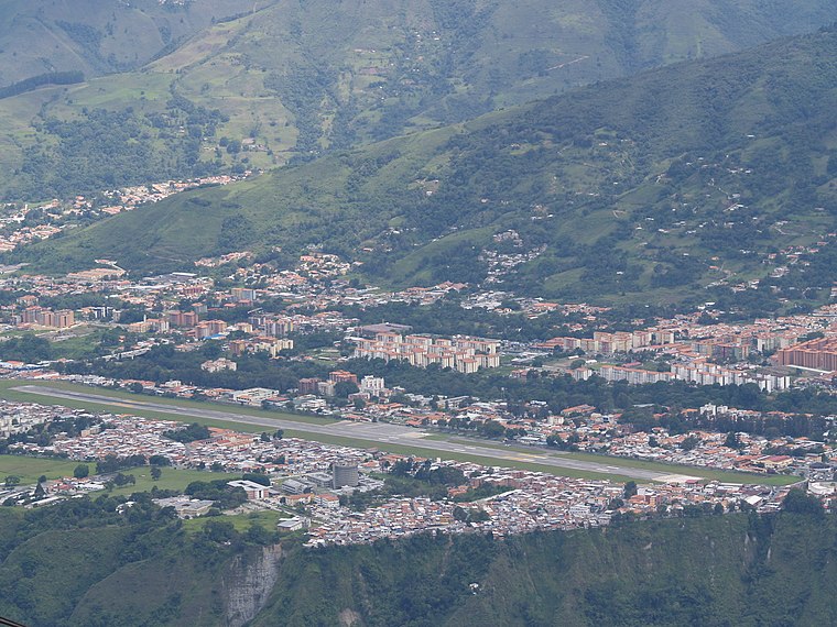
Photo: Wikimedia, Public domain.
Alberto Carnevalli Airport is an airport located 3 km southwest of downtown Mérida, the capital of Mérida State in Venezuela. It is named in honor of Alberto Carnevalli, a Venezuelan lawyer and political activist. Alberto Carnevalli Airport is situated 2½ km northeast of Conjunto Residencial La Estancia.
Places in the Area
Nearby places include Mérida.
Mérida

Photo: venex, CC BY-SA 2.0.
Mérida the capital of Mérida State, is located in Venezuela, at the foot of the Andes, 15 kilometers from Venezuela's highest point. It is the centre for outdoor activities in Venezuela.
Conjunto Residencial La Estancia
- Type: Residential area
- Location: Mérida, Andes, Venezuela, South America
- View on OpenStreetMap
Latitude
8.56998° or 8° 34′ 12″ northLongitude
-71.18086° or 71° 10′ 51″ westOpen location code
67WCHR99+XMOpenStreetMap ID
way 71439870OpenStreetMap feature
landuse=residential
This page is based on OpenStreetMap, Wikidata, and Wikimedia Commons.
We’d love your help improving our open data sources. Thank you for contributing.
Satellite Map
Discover Conjunto Residencial La Estancia from above in high-definition satellite imagery.
Places with the Same Name
Discover other places named “Conjunto Residencial La Estancia”.
Notable Places Nearby
Highlights include C.C. Las Tapias and SAMAT.
Nearby Places
Explore places such as Casa de los Gobernadores and Banco de Venezuela.
Mérida: Must-Visit Destinations
Delve into Mérida, Santo Domingo, and El Vigía.
Curious Residential Areas to Discover
Uncover intriguing residential areas from every corner of the globe.
About Mapcarta. Data © OpenStreetMap contributors and available under the Open Database License". Text is available under the CC BY-SA 4.0 license, except for photos, directions, and the map. Photo: Wikimedia, CC0.