Amapo
Amapo is a building in Cayenne, Guyane which is located on Rue Ernest Prévot. Amapo is situated nearby to the food court wacaï grillade, as well as near Lakadidemi Tanbou Danse.| Tap on a place to explore it |
Places of Interest Nearby
Highlights include Immeuble Vitalo and Musée départemental Alexandre Franconie.
Immeuble Vitalo
Historic building
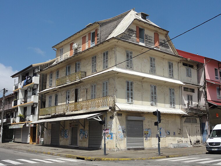
Photo: Aandrem, CC BY-SA 4.0.
Immeuble Vitalo is a historic building, which is situated 560 metres north of Amapo.
Musée départemental Alexandre Franconie
Museum

Photo: Lydav, CC BY-SA 3.0.
Musée départemental Alexandre Franconie is a museum, which is situated 700 metres north of Amapo.
Cayenne Cathedral
Church

Photo: Wikimedia, CC BY-SA 3.0.
Cayenne Cathedral is a Roman Catholic cathedral, seat of the Diocese of Cayenne. It is a national monument of France, located in the town of Cayenne, capital of French Guiana. Cayenne Cathedral is situated 1 km north of Amapo.
Places in the Area
Nearby places include Remire-Montjoly and Matoury.
Remire-Montjoly
Town

Photo: Lebrouillard, CC BY-SA 3.0.
Remire-Montjoly is a commune of French Guiana, an overseas region and department of France located on the northeast coast of South America. Remire-Montjoly is a suburb of Cayenne, the capital préfecture and largest city of French Guiana. Remire-Montjoly is situated 7 km southeast of Amapo.
Matoury
Town

Photo: Bernard DUPONT, CC BY-SA 2.0.
Matoury is a commune of French Guiana, an overseas region and department of France located in South America. Matoury is a southern suburb of Cayenne, the préfecture and largest city of French Guiana. Cayenne – Félix Eboué Airport, the main international airport of French Guiana, is located in the commune of Matoury. Matoury is situated 9 km south of Amapo.
Amapo
- Type: Building
- Address: 46 Rue Ernest Prévot, Cayenne
- Location: Cayenne, Arrondissement of Cayenne, Guyane, French Guiana, South America
- View on OpenStreetMap
Latitude
4.9322° or 4° 55′ 56″ northLongitude
-52.33279° or 52° 19′ 58″ westOpen location code
68P9WMJ8+VVOpenStreetMap ID
way 71470089OpenStreetMap feature
building=yes
This page is based on OpenStreetMap, Wikidata, and Wikimedia Commons.
We’d love your help improving our open data sources. Thank you for contributing.
Satellite Map
Discover Amapo from above in high-definition satellite imagery.
Places with the Same Name
Discover other places named “Amapo”.
Notable Places Nearby
Highlights include wacaï grillade and Lakadidemi Tanbou Danse.
Nearby Places
Explore places such as Restaurant Nena and Croissant Rouge.
French Guiana: Must-Visit Destinations
Delve into Cayenne, Kourou, Saint-Laurent-du-Maroni, and Saint-Georges.
Curious Buildings to Discover
Uncover intriguing buildings from every corner of the globe.
About Mapcarta. Data © OpenStreetMap contributors and available under the Open Database License". Text is available under the CC BY-SA 4.0 license, except for photos, directions, and the map. Photo: Wikimedia, CC0.