Artenschutzturm Thonhausen
Artenschutzturm Thonhausen is a building in Thonhausen, Altenburger Land, Thuringia which is located on Dorfstraße. Artenschutzturm Thonhausen is situated nearby to the church Dorfkirche Thonhausen, as well as near the post office Postfiliale 499.| Tap on a place to explore it |
- Type: Building
- Also known as: “Trafoturm Thonhausen”
- Address: Dorfstraße, 04626
- Roof shape: gabled
Places of Interest Nearby
Highlights include Dorfkirche Thonhausen and Station 122 Fuchsberg.
Dorfkirche Thonhausen
Church

Photo: Lucas Friese, Public domain.
Dorfkirche Thonhausen is a church, which is situated 320 metres north of Artenschutzturm Thonhausen.
Station 122 Fuchsberg
Historic site

Photo: Wikimedia, CC BY-SA 3.0.
Station 122 Fuchsberg is a historic site, which is situated 1¼ km east of Artenschutzturm Thonhausen.
Dorfkirche Wettelswalde
Church

Photo: Lucas Friese, Public domain.
Dorfkirche Wettelswalde is a church, which is situated 1¼ km northwest of Artenschutzturm Thonhausen.
Places in the Area
Nearby places include Wettelswalde and Schönhaide.


Heyersdorf
Village
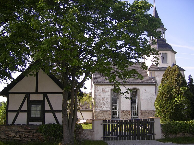
Photo: Lucas Friese, Public domain.
Heyersdorf is a municipality in the Thuringian district of Altenburger Land. Heyersdorf is situated 2½ km northeast of Artenschutzturm Thonhausen.
Artenschutzturm Thonhausen
Latitude
50.83575° or 50° 50′ 9″ northLongitude
12.32358° or 12° 19′ 25″ eastInception
April 2017Height
10 metres (33 feet)Operator
Stiftung Pro Artenvielfalt®Open location code
9F2JR8PF+8COpenStreetMap ID
way 715372726OpenStreetMap feature
building=transformer_towerOpenStreetMap feature
man_made=species_protection_towerOpenStreetMap attribute
roof-shape=gabled
This page is based on OpenStreetMap, Wikidata, and Wikimedia Commons.
We’d love your help improving our open data sources. Thank you for contributing.
Satellite Map
Discover Artenschutzturm Thonhausen from above in high-definition satellite imagery.
Notable Places Nearby
Highlights include Postfiliale 499 and Feuerlöschteich.
Nearby Places
Explore places such as Blumengeschäft Jahn and Fleischerei Rohn.
Curious Buildings to Discover
Uncover intriguing buildings from every corner of the globe.
About Mapcarta. Data © OpenStreetMap contributors and available under the Open Database License". Text is available under the CC BY-SA 4.0 license, except for photos, directions, and the map. Photo: Taxiarchos228, FAL.