Antic abocador de Rocafort de Vallbona
Antic abocador de Rocafort de Vallbona is a landfill in Sant Martí de Riucorb, Lleida, Catalonia. Antic abocador de Rocafort de Vallbona is situated nearby to the residential building Cal Bellart, as well as near the hut Cabana de l’Agustineta.| Tap on a place to explore it |
Places of Interest Nearby
Highlights include Transfiguració de Rocafort de Vallbona and Cal Bellart.
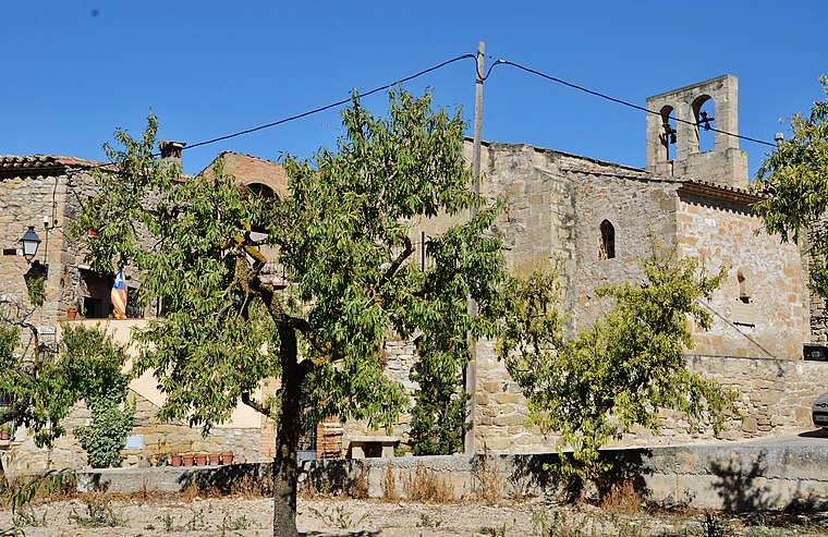
Transfiguració de Rocafort de Vallbona
Church

Photo: Enric, CC BY-SA 4.0.
Transfiguració de Rocafort de Vallbona is a church, which is situated 510 metres northeast of Antic abocador de Rocafort de Vallbona.
Cal Bellart
Residential building

Photo: Enric, CC BY-SA 4.0.
Cal Bellart is a residential building, which is situated 390 metres northeast of Antic abocador de Rocafort de Vallbona.
Castell de Rocafort de Vallbona
Residential building

Photo: Enric, CC BY-SA 4.0.
Castell de Rocafort de Vallbona is a residential building, which is situated 440 metres northeast of Antic abocador de Rocafort de Vallbona.
Places in the Area
Nearby places include Rocafort de Vallbona and El Vilet.

Nalec
Village

Photo: Wikimedia, CC BY-SA 2.5.
Nalec is a municipality in the comarca of the Urgell in Catalonia, Spain. It is situated in the valley of the Corb in the south of the comarca.
Antic abocador de Rocafort de Vallbona
- Type: Landfill
- Location: Sant Martí de Riucorb, Lleida, Catalonia, Eastern Spain, Spain, Iberia, Europe
- View on OpenStreetMap
Latitude
41.55214° or 41° 33′ 8″ northLongitude
1.08949° or 1° 5′ 22″ eastOpen location code
8FH3H32Q+VQOpenStreetMap ID
way 720883815OpenStreetMap feature
landuse=landfill
This page is based on OpenStreetMap, Wikidata, and Wikimedia Commons.
We’d love your help improving our open data sources. Thank you for contributing.
Satellite Map
Discover Antic abocador de Rocafort de Vallbona from above in high-definition satellite imagery.
In Other Languages
“Antic abocador de Rocafort de Vallbona” goes by many names.
- Catalan: “Antic abocador de Rocafort de Vallbona”
Notable Places Nearby
Highlights include Cabana de l’Agustineta and Plaça Major.
Nearby Places
Explore places such as Cal Bellardó and Molí d’oli de Rocafort de Vallbona.
Lleida: Must-Visit Destinations
Delve into Lleida, Val d’Aran, La Seu d’Urgell, and Aigüestortes i Estany de Sant Maurici National Park.
Curious Landfills to Discover
Uncover intriguing landfills from every corner of the globe.
About Mapcarta. Data © OpenStreetMap contributors and available under the Open Database License". Text is available under the CC BY-SA 4.0 license, except for photos, directions, and the map. Photo: Wikimedia, CC0.