Usama
Usama is a mosque in Karachi District, Sindh. Usama is situated nearby to the place of worship Shrine of Syeda Miran Pir, as well as near FG College.| Tap on a place to explore it |
Places of Interest Nearby
Highlights include National Museum of Pakistan and KMC Football Stadium.
National Museum of Pakistan
Museum
 The National Museum of Pakistan is a public museum located in Karachi, Pakistan. National Museum of Pakistan is situated 2 km east of Usama.
KMC Football Stadium
Stadium

Photo: imzeeshankhan, CC BY-SA 3.0.
The KMC Football Stadium, also known as the CDGK Stadium, is an association football stadium in Karachi, Pakistan, with a capacity of around 15,000. The stadium is owned by the Karachi Municipal Corporation. KMC Football Stadium is situated 1 km east of Usama.
Lady Dufferin Hospital
Hospital
Lady Dufferin Hospital is a private women's hospital located in Karachi, Sindh. Lady Dufferin Hospital is situated 1 km east of Usama.
Places in the Area
Nearby places include Mithadar and Lyari.
Mithadar
Suburb
Mithadar is one of the neighbourhoods of Saddar Town in Karachi, Sindh, Pakistan, and comprises the oldest part of Karachi that was once encircled by a wall.
Lyari
Town
Lyari is a historic locality in Karachi, Pakistan. It is the most densely populated part of Karachi, and is one of its earliest settled areas.
Khāradar
Suburb
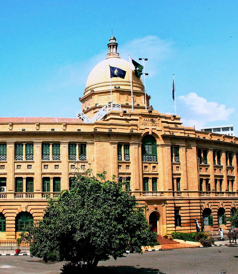
Photo: Wikimedia, CC BY-SA 4.0.
Kharadar is a neighbourhood in District South of Karachi, Pakistan. Kharadar and the adjacent communities of Mithadar and Jodia Bazaar together form what is regarded as the original core of Karachi.
Usama
- Type: Mosque
- Categories: building, place of worship, and religion
- Location: Karachi District, Sindh, Pakistan, South Asia, Asia
- View on OpenStreetMap
Latitude
24.85812° or 24° 51′ 29″ northLongitude
66.99909° or 66° 59′ 57″ eastOpen location code
7JP8VX5X+6JOpenStreetMap ID
way 721027417OpenStreetMap feature
amenity=place_of_worshipOpenStreetMap feature
building=yes
This page is based on OpenStreetMap, Wikidata, and Wikimedia Commons.
We’d love your help improving our open data sources. Thank you for contributing.
Satellite Map
Discover Usama from above in high-definition satellite imagery.
Places with the Same Name
Discover other places named “Usama”.
Notable Places Nearby
Highlights include Shrine of Syeda Miran Pir and Miran Pir Dargah.
Nearby Places
Explore places such as Sindh Bank Limited and Falak Shear Hotel.
Sindh: Must-Visit Destinations
Delve into Karachi, Mohenjo-daro, Hyderabad, and Sukkur.
Curious Mosques to Discover
Uncover intriguing mosques from every corner of the globe.
About Mapcarta. Data © OpenStreetMap contributors and available under the Open Database License". Text is available under the CC BY-SA 4.0 license, except for photos, directions, and the map. Photo: Wikimedia, CC BY 2.0.