St. Paul’s Evangelical Lutheran Church
St. Paul’s Evangelical Lutheran Church is a church in City of Youngstown, Mahoning, Ohio. St. Paul’s Evangelical Lutheran Church is situated nearby to the convention center Stambaugh Auditorium, as well as near the government office MYCAP.| Tap on a place to explore it |
Places of Interest Nearby
Highlights include Stambaugh Stadium and Butler Institute of American Art.
Stambaugh Stadium
Stadium
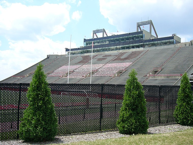
Photo: Blue80, CC BY-SA 3.0.
Stambaugh Stadium, officially Arnold D. Stambaugh Stadium, is a stadium in Youngstown, Ohio, United States, on the campus of Youngstown State University. Stambaugh Stadium is situated 2,000 feet south of St. Paul’s Evangelical Lutheran Church.
Butler Institute of American Art
Museum

Photo: Nina8705, CC BY-SA 4.0.
The Butler Institute of American Art, located on Wick Avenue in Youngstown, Ohio, United States, was the first museum dedicated exclusively to American art. Butler Institute of American Art is situated 3,700 feet southeast of St. Paul’s Evangelical Lutheran Church.
St. Columba Cathedral
Church

Photo: Nyttend, Public domain.
St. Columba Cathedral is a parish and the cathedral church of the Roman Catholic Diocese of Youngstown, in Youngstown, Ohio, United States. St. Columba Cathedral is situated 4,100 feet south of St. Paul’s Evangelical Lutheran Church.
Places in the Area
Nearby places include Youngstown and Brier Hill.
Youngstown

Photo: Wallydoggy, CC BY-SA 4.0.
Youngstown is a city of 60,000 people in Northeast Ohio and is the county seat of Mahoning County. For Youngstown, it was all about coal and steel, until deindustrialization occurred in the second half of the 20th century.
Brier Hill
Quarter
Brier Hill is a neighborhood in Youngstown, Ohio, that was once viewed as the city's "Little Italy." The neighborhood, which was the site of the city's first Italian settlement, stretches along the western edge of Youngstown's lower north side and encircles St.
Haselton
Quarter

Photo: Nyttend, Public domain.
Hazelton is a neighborhood in Youngstown, Ohio, located on the city's east side. It is bordered by the cities of Struthers and Campbell. In the early 20th century, the neighborhood was alternately referred to as "the East End". Haselton is situated 3 miles southeast of St. Paul’s Evangelical Lutheran Church.
St. Paul’s Evangelical Lutheran Church
- Type: Church
- Categories: building, place of worship, and religion
- Location: City of Youngstown, Mahoning, Ohio, Midwest, United States, North America
- View on OpenStreetMap
Latitude
41.11475° or 41° 6′ 53″ northLongitude
-80.65209° or 80° 39′ 8″ westOpen location code
86HX487X+W5OpenStreetMap ID
way 721966003OpenStreetMap feature
amenity=place_of_worshipOpenStreetMap feature
building=church
This page is based on OpenStreetMap, Wikidata, and Wikimedia Commons.
We’d love your help improving our open data sources. Thank you for contributing.
Satellite Map
Discover St. Paul’s Evangelical Lutheran Church from above in high-definition satellite imagery.
Places with the Same Name
Discover other places named “St. Paul’s Evangelical Lutheran Church”.
Notable Places Nearby
Highlights include Stambaugh Auditorium and MYCAP.
Nearby Places
Explore places such as Weecare Daycare and Park Vista South.
Ohio: Must-Visit Destinations
Delve into Columbus, Cincinnati, Cleveland, and Bowling Green.
Curious Churches to Discover
Uncover intriguing churches from every corner of the globe.
About Mapcarta. Data © OpenStreetMap contributors and available under the Open Database License". Text is available under the CC BY-SA 4.0 license, except for photos, directions, and the map. Photo: Wikimedia, CC0.