Forme de radoub nº 2
Forme de radoub nº 2 is a dock in Brest, Finistère, Brittany. Forme de radoub nº 2 is situated nearby to the pier QR1, as well as near QR4.| Tap on a place to explore it |
Places of Interest Nearby
Highlights include Stade Francis-Le Blé and Brest station.
Stade Francis-Le Blé
Stadium

Photo: Brestois029200, CC BY-SA 3.0.
The Stade Francis-Le Blé, formerly known as the Stade de l'Armoricaine, is a multi-use stadium in Brest, France. It is currently used mostly for football matches and is the home stadium of Stade Brestois 29. Stade Francis-Le Blé is situated 2 km north of Forme de radoub nº 2.
Brest station
Railway station
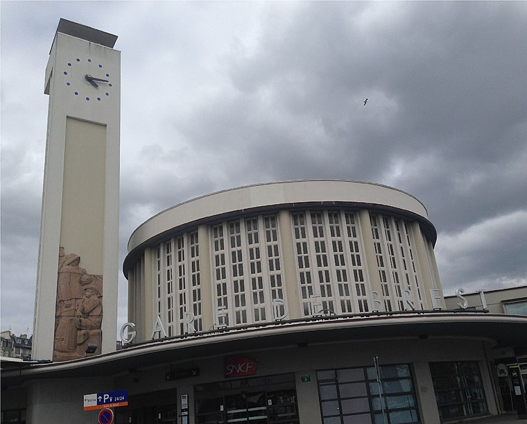
Photo: AirScott, CC BY-SA 4.0.
Brest station is the railway station serving Brest, France. It is the western terminus of the Paris–Brest railway. The new station, built above the town's harbour in 1932 on the site of its 1865 predecessor, includes a tall clock tower and a semi circle passenger hall. Brest station is situated 1½ km west of Forme de radoub nº 2.
Oceanopolis
Public aquarium

Photo: CaptainHaddock, CC BY-SA 3.0.
Oceanopolis is a public aquarium, which is situated 1½ km east of Forme de radoub nº 2.
Places in the Area
Nearby places include Saint-Marc and Porte Tourville.

Porte Tourville
Locality

Photo: Wikimedia, CC BY-SA 4.0.
Porte Tourville is a locality, which is situated 2½ km west of Forme de radoub nº 2.
Jean Bart Gate
Locality

Photo: Wikimedia, Public domain.
Jean Bart Gate is a locality, which is situated 3 km west of Forme de radoub nº 2.
Forme de radoub nº 2
- Type: Dock
- Category: transportation
- Location: Brest, Arrondissement de Brest, Finistère, Brittany, France, Europe
- View on OpenStreetMap
Latitude
48.38652° or 48° 23′ 12″ northLongitude
-4.45852° or 4° 27′ 31″ westOpen location code
8CWQ9GPR+JHOpenStreetMap ID
way 72234215OpenStreetMap feature
waterway=dock
This page is based on OpenStreetMap, Wikidata, and Wikimedia Commons.
We’d love your help improving our open data sources. Thank you for contributing.
Satellite Map
Discover Forme de radoub nº 2 from above in high-definition satellite imagery.
Notable Places Nearby
Highlights include QR1 and QR4.
Nearby Places
Explore places such as Z.I. Portuaire and Locoutils.
Brittany: Must-Visit Destinations
Delve into Rennes, Finistère, Ille-et-Vilaine, and Morbihan.
Curious Docks to Discover
Uncover intriguing docks from every corner of the globe.
About Mapcarta. Data © OpenStreetMap contributors and available under the Open Database License". Text is available under the CC BY-SA 4.0 license, except for photos, directions, and the map. Photo: Inkey, CC BY-SA 2.5.