Cross Country
Cross Country is a recreation area in City of Rochester, Olmsted, Minnesota. Cross Country is situated nearby to the pitch Soccer, as well as near the school building Century High School.| Tap on a place to explore it |
Places of Interest Nearby
Highlights include Century High School and Federal Medical Center.
Century High School
School building
 Century High School is a public high school located in Rochester, Minnesota, United States. It is a member of Independent School District #535 with more than 1,600 students. Century High School is situated 400 feet northeast of Cross Country.
Federal Medical Center
Prison
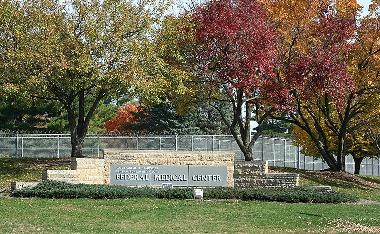
Photo: Jonathunder, GFDL.
The Federal Medical Center, Rochester is a United States federal prison in Minnesota for male inmates requiring specialized or long-term medical or mental health care. Federal Medical Center is situated 2 miles south of Cross Country.
Mayo Civic Center
The Mayo Civic Center is a multi-purpose convention center and event facility in Rochester, Minnesota. It was home to the Rochester Mustangs ice hockey team and various professional basketball franchises. Mayo Civic Center is situated 2½ miles southwest of Cross Country.Places in the Area
Nearby places include Rochester.
Rochester

Photo: Michael Hicks, CC BY 2.0.
Rochester, Minnesota, about 80 miles southeast of Minneapolis/St. Paul, is home to the Mayo Clinic. Rochester is cold in the winter and warm, and many times hot, in the summer.
Cross Country
- Type: Recreation area
- Categories: tourist attraction and tourism
- Location: City of Rochester, Olmsted, Minnesota, Midwest, United States, North America
- View on OpenStreetMap
Latitude
44.04921° or 44° 2′ 57″ northLongitude
-92.42593° or 92° 25′ 33″ westOpen location code
86P92HXF+MJOpenStreetMap ID
way 728243553OpenStreetMap feature
landuse=recreation_ground
This page is based on OpenStreetMap, Wikidata, and Wikimedia Commons.
We’d love your help improving our open data sources. Thank you for contributing.
Satellite Map
Discover Cross Country from above in high-definition satellite imagery.
Places with the Same Name
Discover other places named “Cross Country”.
Notable Places Nearby
Highlights include Soccer and Freshman Pond.
Nearby Places
Explore places such as Century High School and Quarry Hill Park Animal Hospital.
Minnesota: Must-Visit Destinations
Delve into Minneapolis, Saint Paul, Duluth, and Rochester.
Curious Recreation Areas to Discover
Uncover intriguing recreation areas from every corner of the globe.
About Mapcarta. Data © OpenStreetMap contributors and available under the Open Database License". Text is available under the CC BY-SA 4.0 license, except for photos, directions, and the map. Photo: Wikimedia, CC0.