Ersatzkraftwerk - I72
Ersatzkraftwerk - I72 is an industrial building in Schkopau, Saalekreis, Saxony-Anhalt. Ersatzkraftwerk - I72 is situated nearby to the settling basin O65, as well as near O56b.| Tap on a place to explore it |
Places of Interest Nearby
Highlights include Protestant Church Korbetha and Schloss Schkopau.
Protestant Church Korbetha
Church
 Protestant Church Korbetha is situated 1 km north of Ersatzkraftwerk - I72.
Schloss Schkopau
Castle

Photo: Danny Smith, CC BY-SA 2.0.
Schloss Schkopau is a castle, which is situated 2 km east of Ersatzkraftwerk - I72.
Evangelische Kirche Schkopau
Church

Photo: ErwinMeier, CC BY-SA 4.0.
Evangelische Kirche Schkopau is a church, which is situated 1½ km east of Ersatzkraftwerk - I72.
Places in the Area
Nearby places include Schkopau and Dörstewitz.
Schkopau
Town
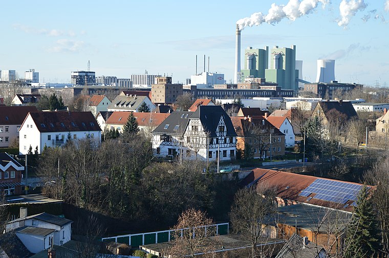
Photo: Olaf2, CC BY-SA 4.0.
Schkopau is a municipality in the Saalekreis district, in Saxony-Anhalt, Germany.
Dörstewitz
Village

Photo: Jwaller, CC BY-SA 3.0.
Dörstewitz is a village, which is situated 2½ km west of Ersatzkraftwerk - I72.
Delitz am Berge
Village
 Delitz am Berge is a former municipality in the Saalekreis district, Saxony-Anhalt, Germany. Since January 2008, it has been part of the town of Bad Lauchstädt. Delitz am Berge is situated 4½ km northwest of Ersatzkraftwerk - I72.
Ersatzkraftwerk - I72
- Type: Industrial building
- Categories: building and industry
- Location: Schkopau, Saalekreis, Saxony-Anhalt, Germany, Central Europe, Europe
- View on OpenStreetMap
Latitude
51.39672° or 51° 23′ 48″ northLongitude
11.95849° or 11° 57′ 31″ eastOpen location code
9F3H9XW5+M9OpenStreetMap ID
way 732589586OpenStreetMap feature
building=industrial
This page is based on OpenStreetMap, Wikidata, and Wikimedia Commons.
We’d love your help improving our open data sources. Thank you for contributing.
Satellite Map
Discover Ersatzkraftwerk - I72 from above in high-definition satellite imagery.
Notable Places Nearby
Highlights include O65 and O56b.
Nearby Places
Explore places such as K73 and I74.
Saxony-Anhalt: Must-Visit Destinations
Delve into Magdeburg, Halle, Wittenberg, and Quedlinburg.
Curious Industrial Buildings to Discover
Uncover intriguing industrial buildings from every corner of the globe.
About Mapcarta. Data © OpenStreetMap contributors and available under the Open Database License". Text is available under the CC BY-SA 4.0 license, except for photos, directions, and the map. Photo: GMM, Public domain.