Venelle Montaigu
Venelle Montaigu is a building in Caen, Calvados, Normandy. Venelle Montaigu is situated nearby to the park Square de la Cavée, as well as near École de danse Sophie Berra.| Tap on a place to explore it |
Places of Interest Nearby
Highlights include Abbey of Saint-Étienne, Caen and Préfecture du Calvados.
Abbey of Saint-Étienne, Caen
Monastery
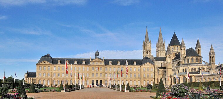
Photo: Viault, CC BY-SA 3.0.
The Abbey of Saint-Étienne, also known as Abbaye aux Hommes by contrast with the Abbaye aux Dames, is a former Benedictine monastery in the French city of Caen, Normandy, dedicated to Saint Stephen. Abbey of Saint-Étienne, Caen is situated 1¼ km northwest of Venelle Montaigu.
Préfecture du Calvados
Public building

Photo: Karldupart, CC BY-SA 3.0.
Préfecture du Calvados is a public building, which is situated 1 km north of Venelle Montaigu.
Caen station
Railway station
 Caen, Gare de l'Ouest or Gare Calvados, is the main and now only station serving the city of Caen, Normandy, France. The station stands on the main line from Paris to Cherbourg and although it mainly is an intercity station many regional trains use the station. Caen station is situated 1¼ km northeast of Venelle Montaigu.
Places in the Area
Nearby places include Vaucelles and Vaugueux.


Venelle Montaigu
- Type: Building
- Location: Caen, Arrondissement of Caen, Calvados, Normandy, France, Europe
- View on OpenStreetMap
Latitude
49.17175° or 49° 10′ 18″ northLongitude
-0.36273° or 0° 21′ 46″ westOperator
EnedisOpen location code
8CXX5JCP+PWOpenStreetMap ID
way 738488899OpenStreetMap feature
building=service
This page is based on OpenStreetMap, Wikidata, and Wikimedia Commons.
We’d love your help improving our open data sources. Thank you for contributing.
Satellite Map
Discover Venelle Montaigu from above in high-definition satellite imagery.
Notable Places Nearby
Highlights include Square de la Cavée and École de danse Sophie Berra.
Nearby Places
Explore places such as Résidence du clos des Marronniers and Lechesne.
Calvados: Must-Visit Destinations
Delve into Lisieux, Bayeux, Honfleur, and Deauville.
Curious Buildings to Discover
Uncover intriguing buildings from every corner of the globe.
About Mapcarta. Data © OpenStreetMap contributors and available under the Open Database License". Text is available under the CC BY-SA 4.0 license, except for photos, directions, and the map. Photo: Viault, CC BY-SA 3.0.