Kleingartenanlage Rettelmühle
Kleingartenanlage Rettelmühle is an allotment garden in Schwerte, Unna, North Rhine-Westphalia. Kleingartenanlage Rettelmühle is situated nearby to the cemetery Friedhof Wandhofen, as well as near the post office Deutsche Post.| Tap on a place to explore it |
Places of Interest Nearby
Highlights include Haus Ruhr and Ebberg.
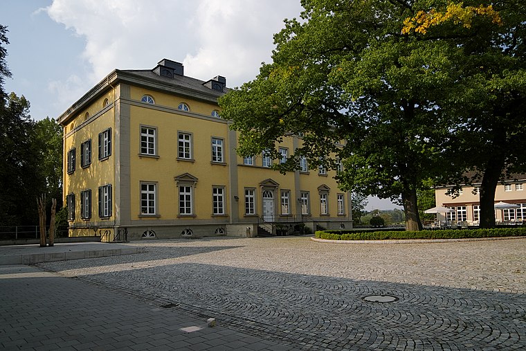
Haus Ruhr
Castle

Photo: Pimvantend, CC BY-SA 3.0.
Haus Ruhr is a castle, which is situated 550 metres south of Kleingartenanlage Rettelmühle.

Haus Steinhausen
Ruins

Photo: Helfmann, CC BY-SA 3.0.
Haus Steinhausen is a ruins, which is situated 1½ km northwest of Kleingartenanlage Rettelmühle.
Places in the Area
Nearby places include Westhofen and Ergste.

Ergste
Suburb
Ergste is a stadtbezirk of the town of Schwerte in Germany. As of 31 December 2012, Ergste had a population of 7025 inhabitants. It lies south of the river Ruhr near Sauerland.
Villigst
Suburb
 Villigst is a Stadtteil of the city Schwerte in North Rhine-Westphalia, Germany. On 31 December 2012, Villigst had a population of 3.309 inhabitants. It lies south of the river Ruhr near Sauerland. Villigst is situated 3 km east of Kleingartenanlage Rettelmühle.
Kleingartenanlage Rettelmühle
- Type: Allotment garden
- Location: Schwerte, Unna, Arnsberg, North Rhine-Westphalia, Germany, Central Europe, Europe
- View on OpenStreetMap
Latitude
51.42572° or 51° 25′ 33″ northLongitude
7.54465° or 7° 32′ 41″ eastOpen location code
9F39CGGV+7VOpenStreetMap ID
way 739170664OpenStreetMap feature
landuse=allotments
This page is based on OpenStreetMap, Wikidata, and Wikimedia Commons.
We’d love your help improving our open data sources. Thank you for contributing.
Satellite Map
Discover Kleingartenanlage Rettelmühle from above in high-definition satellite imagery.
Notable Places Nearby
Highlights include Friedhof Wandhofen and Deutsche Post.
Nearby Places
Explore places such as Rettelmühle and Ruhrakademie.
North Rhine-Westphalia: Must-Visit Destinations
Delve into Cologne, Düsseldorf, Bonn, and Dortmund.
Curious Allotment Gardens to Discover
Uncover intriguing allotment gardens from every corner of the globe.
About Mapcarta. Data © OpenStreetMap contributors and available under the Open Database License". Text is available under the CC BY-SA 4.0 license, except for photos, directions, and the map. Photo: Daniel Schwen, CC BY-SA 2.5.