Espace Jules Ferry
Espace Jules Ferry is a park in Canton of Belley, Arrondissement of Belley, Auvergne-Rhône-Alpes. Espace Jules Ferry is situated nearby to the historic building Former prison of Belley, as well as near the sports venue Gymnase Jean Morin.| Tap on a place to explore it |
Places of Interest Nearby
Highlights include Former prison of Belley and Ancien hôtel de ville de Belley.
Former prison of Belley
Historic building
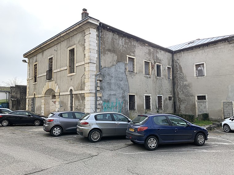 Former prison of Belley is a historic building, which is situated 120 metres west of Espace Jules Ferry.
Ancien hôtel de ville de Belley
Historic building

Photo: Chabe01, CC BY-SA 4.0.
Ancien hôtel de ville de Belley is a historic building, which is situated 290 metres southwest of Espace Jules Ferry.
Hôtel de province du Bugey
Historic building
 Hôtel de province du Bugey is a historic building, which is situated 310 metres southwest of Espace Jules Ferry.
Places in the Area
Nearby places include Belley and Chazey.
Belley
Town

Photo: ComBelley, CC BY-SA 3.0.
Belley is a subprefecture of the Ain department in the Auvergne-Rhône-Alpes region, France. It is the capital of the historical region of Bugey, although not its largest city, which is Oyonnax, to the north. In 2020, the commune had a population of 9,207.


Espace Jules Ferry
- Type: Park
- Category: recreation area
- Location: Canton of Belley, Arrondissement of Belley, Ain, Auvergne-Rhône-Alpes, France, Europe
- View on OpenStreetMap
Latitude
45.76126° or 45° 45′ 41″ northLongitude
5.69056° or 5° 41′ 26″ eastInception
December 9th, 2010Open location code
8FQ7QM6R+G6OpenStreetMap ID
way 743672963OpenStreetMap feature
leisure=park
This page is based on OpenStreetMap, Wikidata, and Wikimedia Commons.
We’d love your help improving our open data sources. Thank you for contributing.
Satellite Map
Discover Espace Jules Ferry from above in high-definition satellite imagery.
Notable Places Nearby
Highlights include Gymnase Jean Morin and Police municipale.
Nearby Places
Explore places such as École primaire Les Charmilles and Lycée professionnel du Bugey.
Auvergne-Rhône-Alpes: Must-Visit Destinations
Delve into Lyon, Grenoble, Clermont-Ferrand, and Saint-Étienne.
Curious Parks to Discover
Uncover intriguing parks from every corner of the globe.
About Mapcarta. Data © OpenStreetMap contributors and available under the Open Database License". Text is available under the CC BY-SA 4.0 license, except for photos, directions, and the map. Photo: Inkey, CC BY-SA 3.0.