Parkeerplaats TOP Rotering-Oldenkotte
Parkeerplaats TOP Rotering-Oldenkotte is a parking area in Vreden, Borken, North Rhine-Westphalia. Parkeerplaats TOP Rotering-Oldenkotte is situated nearby to the church St. Antonius, as well as near Ten Brinke Fiets- en Kanoverhuur.| Tap on a place to explore it |
Places of Interest Nearby
Highlights include Antoniuskerk and Krosewicker Grenzwald.
Antoniuskerk
Church

Photo: Wikimedia, CC BY-SA 4.0.
Antoniuskerk is a church, which is situated 2 km west of Parkeerplaats TOP Rotering-Oldenkotte.
Krosewicker Grenzwald
Nature reserve

Photo: Gouwenaar, Public domain.
Krosewicker Grenzwald is a nature reserve, which is situated 3½ km southwest of Parkeerplaats TOP Rotering-Oldenkotte.
De Piepermolen
Windmill

Photo: Quistnix, CC BY-SA 2.5.
De Piepermolen is a windmill, which is situated 3 km west of Parkeerplaats TOP Rotering-Oldenkotte.
Places in the Area
Nearby places include Rekken and Haaksbergen.
Rekken
Village

Photo: Michielverbeek, CC BY-SA 4.0.
Rekken is a village in the Dutch municipality of Berkelland. It lies in the most northeast corner of the province of Gelderland, about half a mile from the German border.
Haaksbergen

Photo: Frans-Banja Mulder, CC BY 3.0.
Haaksbergen is a municipality and a town in the eastern Netherlands, in the province of Overijssel, in the Twente region. The Buurserbeek flows through the municipality of Haaksbergen.
Lünten
Village
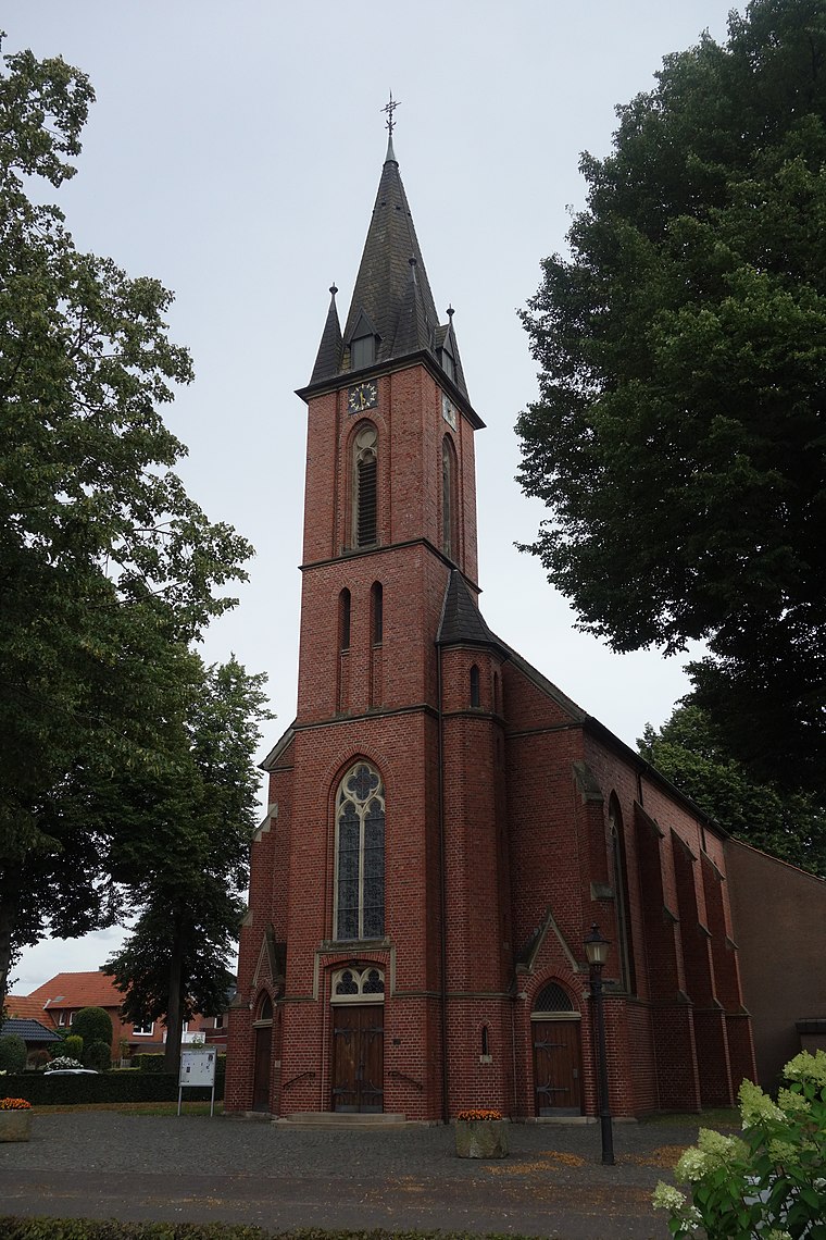
Photo: Vysotsky, CC BY-SA 4.0.
Lünten is a village, which is situated 7 km east of Parkeerplaats TOP Rotering-Oldenkotte.
Parkeerplaats TOP Rotering-Oldenkotte
- Type: Parking area
- Parking: street-side
- Category: transportation
- Location: Vreden, Borken, Münster, North Rhine-Westphalia, Germany, Central Europe, Europe
- View on OpenStreetMap
Latitude
52.09799° or 52° 5′ 53″ northLongitude
6.75591° or 6° 45′ 21″ eastOpen location code
9F483QX4+59OpenStreetMap ID
way 745674669OpenStreetMap feature
amenity=parkingOpenStreetMap attribute
parking=street_side
This page is based on OpenStreetMap, Wikidata, and Wikimedia Commons.
We’d love your help improving our open data sources. Thank you for contributing.
Satellite Map
Discover Parkeerplaats TOP Rotering-Oldenkotte from above in high-definition satellite imagery.
Notable Places Nearby
Highlights include St. Antonius and Ten Brinke Fiets- en Kanoverhuur.
Nearby Places
Explore places such as Kapsalon Evelien and Grenswinkel.
North Rhine-Westphalia: Must-Visit Destinations
Delve into Cologne, Düsseldorf, Bonn, and Dortmund.
Curious Parking Areas to Discover
Uncover intriguing parking areas from every corner of the globe.
About Mapcarta. Data © OpenStreetMap contributors and available under the Open Database License". Text is available under the CC BY-SA 4.0 license, except for photos, directions, and the map. Photo: Daniel Schwen, CC BY-SA 2.5.