Telekom-Tower
Telekom-Tower is a building in Graz, Styria. Telekom-Tower is situated nearby to the church Welsche Kirche, Graz, as well as near the memorial Ecce-Homo-Säule, Griesplatz, Graz.| Tap on a place to explore it |
Places of Interest Nearby
Highlights include Welsche Kirche, Graz and Griesplatz.

Griesplatz
Square
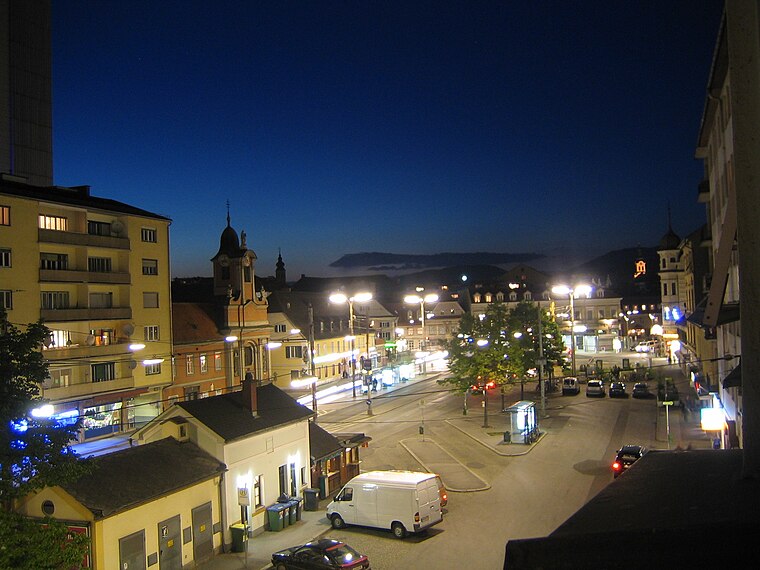
Photo: Freezerfreezer, CC BY-SA 2.5.
Griesplatz is a square, which is situated 110 metres southeast of Telekom-Tower.
Kunsthaus Graz
Museum
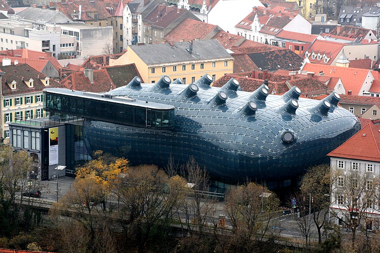
Photo: Wikimedia, CC BY-SA 2.5.
The Kunsthaus Graz, Grazer Kunsthaus, or Graz Art Museum was built as part of the European Capital of Culture celebrations in 2003 and has since become an architectural landmark in Graz, Austria. Kunsthaus Graz is situated 630 metres northeast of Telekom-Tower.
Places in the Area
Nearby places include Gries and Innere Stadt.
Gries
Suburb
Photo: Freezerfreezer, CC BY-SA 2.5.
Gries is the 5th District of the Austrian city of Graz. It is the location of Graz's red-light district.
Innere Stadt
Suburb

Photo: Wikimedia, CC BY-SA 3.0.
Innere Stadt is the 1st city-district of the Austrian city of Graz, capital of the state of Styria. It is the part of the Old Town containing the Schloßberg and the city park.
Jakomini
Suburb
Jakomini is the 6th district of Austrian city of Graz. It is named after Kaspar Andreas Ritter von Jacomini and covers an area of 4,06 square kilometers.
Telekom-Tower
- Type: Building
- Location: Graz, Styria, Austria, Central Europe, Europe
- View on OpenStreetMap
Latitude
47.06625° or 47° 3′ 59″ northLongitude
15.43034° or 15° 25′ 49″ eastLevels
15Height
65 metres (213 feet)Open location code
8FVQ3C8J+G4OpenStreetMap ID
way 74662577OpenStreetMap feature
building=skyscraper
This page is based on OpenStreetMap, Wikidata, and Wikimedia Commons.
We’d love your help improving our open data sources. Thank you for contributing.
Satellite Map
Discover Telekom-Tower from above in high-definition satellite imagery.
Places with the Same Name
Discover other places named “Telekom-Tower”.
Notable Places Nearby
Highlights include Ecce-Homo-Säule, Griesplatz, Graz and Trattenbach’sches Haus.
Nearby Places
Explore places such as Vermittlungsstelle #316-91 Graz-Gries and Griesplatz/Rösselmühlgasse.
Styria: Must-Visit Destinations
Delve into Leoben, Bruck an der Mur, Kapfenberg, and Schladming.
Curious Buildings to Discover
Uncover intriguing buildings from every corner of the globe.
About Mapcarta. Data © OpenStreetMap contributors and available under the Open Database License". Text is available under the CC BY-SA 4.0 license, except for photos, directions, and the map. Photo: Traveler100, CC BY-SA 3.0.