Marienfriedhof
Marienfriedhof is a cemetery in Witten, Ennepe-Ruhr-Kreis, North Rhine-Westphalia. Marienfriedhof is situated nearby to the church Trauerhalle, as well as near Good Mood House.| Tap on a place to explore it |
Places of Interest Nearby
Highlights include Marian-Hospital and Jewish cemetery Ledderken.

Jewish cemetery Ledderken
Heritage site
 Jewish cemetery Ledderken is a heritage site, which is situated 180 metres southeast of Marienfriedhof.
St. Marien
Church
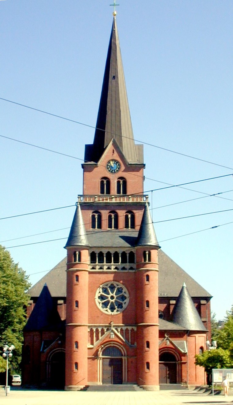
Photo: Jty, CC BY-SA 3.0.
St. Marien is a church, which is situated 200 metres southwest of Marienfriedhof.
Places in the Area
Nearby places include Crengeldanz and Krone.


Witten-Wullen
Neighborhood

Photo: Wikimedia, CC BY-SA 3.0.
Wullen is a city-district of Witten-Annen, which is a part of the City of Witten. Wullen is placed about 3 kilometres northeast of the City of Witten.
Marienfriedhof
- Type: Cemetery
- Denomination: Roman Catholic
- Category: burial
- Location: Witten, Ennepe-Ruhr-Kreis, Arnsberg, Ruhr, North Rhine-Westphalia, Germany, Central Europe, Europe
- View on OpenStreetMap
Latitude
51.44726° or 51° 26′ 50″ northLongitude
7.33823° or 7° 20′ 18″ eastNamed after
MaryOpen location code
9F39C8WQ+W7OpenStreetMap ID
way 74866913OpenStreetMap feature
landuse=cemeteryOpenStreetMap attribute
denomination=roman_catholic
This page is based on OpenStreetMap, Wikidata, and Wikimedia Commons.
We’d love your help improving our open data sources. Thank you for contributing.
Satellite Map
Discover Marienfriedhof from above in high-definition satellite imagery.
Places with the Same Name
Discover other places named “Marienfriedhof”.
Notable Places Nearby
Highlights include Marienfriedhof and Trauerhalle.
Nearby Places
Explore places such as Findus Bau and Caritas association.
Ruhr: Must-Visit Destinations
Delve into Dortmund, Essen, Duisburg, and Bochum.
Curious Cemeteries to Discover
Uncover intriguing cemeteries from every corner of the globe.
About Mapcarta. Data © OpenStreetMap contributors and available under the Open Database License". Text is available under the CC BY-SA 4.0 license, except for photos, directions, and the map. Photo: Raenmaen, CC BY-SA 3.0.