Hospiz Sinus Barmbek
Hospiz Sinus Barmbek is a social service facility in Hamburg, Hamburg which is located on Saarlandstraße. Hospiz Sinus Barmbek is situated nearby to the arts center Die Heilanstalt, as well as near the heritage site Saarlandstraße 30.| Tap on a place to explore it |
Places of Interest Nearby
Highlights include Saarlandstraße 30 and Schleidenbrücke.
Saarlandstraße 30
Heritage site

Photo: Minderbinder, CC BY-SA 4.0.
Saarlandstraße 30 is a heritage site.
Schleidenbrücke
Bridge

Photo: Ajepbah, CC BY-SA 3.0 de.
Schleidenbrücke is a bridge, which is situated 210 metres south of Hospiz Sinus Barmbek.
Saarlandstraße station
Metro station

Photo: Ingolf, CC BY-SA 2.0.
Saarlandstraße is a rapid transit station on the Hamburg U-Bahn line U3. The station was opened in May 1912 and is located in the Hamburg district of Winterhude, Germany. Winterhude is part of the borough of Hamburg-Nord. Saarlandstraße station is situated 310 metres northwest of Hospiz Sinus Barmbek.
Places in the Area
Nearby places include Jarrestadt and Barmbek-Süd.

Barmbek-Süd
Suburb
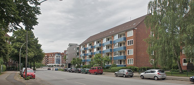
Photo: flamenc, CC BY-SA 3.0.
Barmbek-Süd is a quarter of Hamburg, Germany, in the borough of Hamburg-Nord. It is located in the east of Hamburg-Nord, approximately five kilometers from Hamburg city center.
Barmbek-Nord
Suburb

Photo: Mogelzahn, CC BY-SA 2.5.
Barmbek-Nord is a quarter of Hamburg, Germany, in the borough of Hamburg-Nord. It is located in the east of Hamburg-Nord, approximately five kilometers from Hamburg city center.
Hospiz Sinus Barmbek
- Type: Social service facility
- Address: Saarlandstraße 26, Hamburg, 22303
- Location: Hamburg, Hamburg, Freie und Hansestadt, Hamburg, Germany, Central Europe, Europe
- View on OpenStreetMap
Latitude
53.58666° or 53° 35′ 12″ northLongitude
10.03408° or 10° 2′ 3″ eastOperator
Hospiz Sinus Barmbek gGmbHOpen location code
9F5GH2PM+MJOpenStreetMap ID
way 760925519OpenStreetMap feature
amenity=social_facility
This page is based on OpenStreetMap, Wikidata, and Wikimedia Commons.
We’d love your help improving our open data sources. Thank you for contributing.
Satellite Map
Discover Hospiz Sinus Barmbek from above in high-definition satellite imagery.
Notable Places Nearby
Highlights include Die Heilanstalt and Hansa Yoga.
Nearby Places
Explore places such as U Saarlandstraße (Süd) and Cambio HAM Eisenwerk.
Hamburg: Must-Visit Destinations
Delve into Altona-St. Pauli, Neustadt-Altstadt, East Hamburg, and North Hamburg.
Curious Social Service Facilities to Discover
Uncover intriguing social service facilities from every corner of the globe.
About Mapcarta. Data © OpenStreetMap contributors and available under the Open Database License". Text is available under the CC BY-SA 4.0 license, except for photos, directions, and the map. Photo: Joerg Moellenkamp, CC BY 2.0.