Besucherparkplatz Tierheim
Besucherparkplatz Tierheim is a parking area in Villach, Carinthia. Besucherparkplatz Tierheim is situated nearby to Life Church, as well as near the cemetery Waldfriedhof.| Tap on a place to explore it |
Places of Interest Nearby
Highlights include Filialkirche Sankt Georgen and Dinzlschloss.
Filialkirche Sankt Georgen
Church
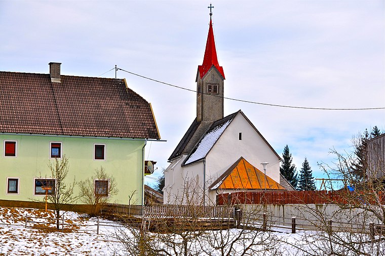
Photo: Johann Jaritz, CC BY-SA 3.0 at.
Filialkirche Sankt Georgen is a church, which is situated 1 km west of Besucherparkplatz Tierheim.
Dinzlschloss
Castle

Photo: Mefusbren69, Public domain.
Dinzlschloss is a castle, which is situated 1¼ km east of Besucherparkplatz Tierheim.
Stadthalle
Stadium

Photo: Mefusbren69, Public domain.
Stadthalle Villach is an indoor sporting arena located in Villach, Austria. The arena has a capacity of 4,500 people and was built in 1969. It is currently home to the EC VSV ice hockey team of the Austrian Hockey League. Stadthalle is situated 1½ km southeast of Besucherparkplatz Tierheim.
Places in the Area
Nearby places include Maria Gail and Landskron.
Maria Gail
Suburb

Photo: Johann Jaritz, CC BY-SA 4.0.
Maria Gail is a suburb, which is situated 5 km southeast of Besucherparkplatz Tierheim.
Landskron
Suburb

Photo: Bwag, CC BY-SA 4.0.
Landskron is a suburb, which is situated 6 km east of Besucherparkplatz Tierheim.
Treffen am Ossiacher See
Village

Photo: Johann Jaritz, CC BY-SA 4.0.
Treffen am Ossiacher See is a market town in the district of Villach-Land in Carinthia in south-central Austria. Treffen am Ossiacher See is situated 6 km northeast of Besucherparkplatz Tierheim.
Besucherparkplatz Tierheim
- Type: Parking area
- Category: transportation
- Location: Villach, Carinthia, Austria, Central Europe, Europe
- View on OpenStreetMap
Latitude
46.6201° or 46° 37′ 12″ northLongitude
13.81475° or 13° 48′ 53″ eastOpen location code
8FRMJRC7+2VOpenStreetMap ID
way 761432245OpenStreetMap feature
amenity=parking
This page is based on OpenStreetMap, Wikidata, and Wikimedia Commons.
We’d love your help improving our open data sources. Thank you for contributing.
Satellite Map
Discover Besucherparkplatz Tierheim from above in high-definition satellite imagery.
Notable Places Nearby
Highlights include Life Church and Waldfriedhof.
Nearby Places
Explore places such as Kärntner Tierschutzverein Villach and Neufellach Tierheim.
Carinthia: Must-Visit Destinations
Delve into Klagenfurt, Wörthersee, Spittal an der Drau, and Friesach.
Curious Parking Areas to Discover
Uncover intriguing parking areas from every corner of the globe.
About Mapcarta. Data © OpenStreetMap contributors and available under the Open Database License". Text is available under the CC BY-SA 4.0 license, except for photos, directions, and the map. Photo: Wikimedia, CC BY-SA 3.0.