PD Trebević
PD Trebević is a mountain hut in Republika Srpska, Bosnia and Herzegovina. PD Trebević is situated nearby to the peak Bijela stijena, as well as near the spring Tri Budalaša.| Tap on a place to explore it |
Places of Interest Nearby
Highlights include Trebević and War childhood museum.
Trebević
Peak

Photo: J budissin, CC BY-SA 4.0.
Trebević is a mountain in central Bosnia and Herzegovina, located in the territories of Republika Srpska, Sarajevo and Istočno Sarajevo, bordering Jahorina mountain.
War childhood museum
Museum
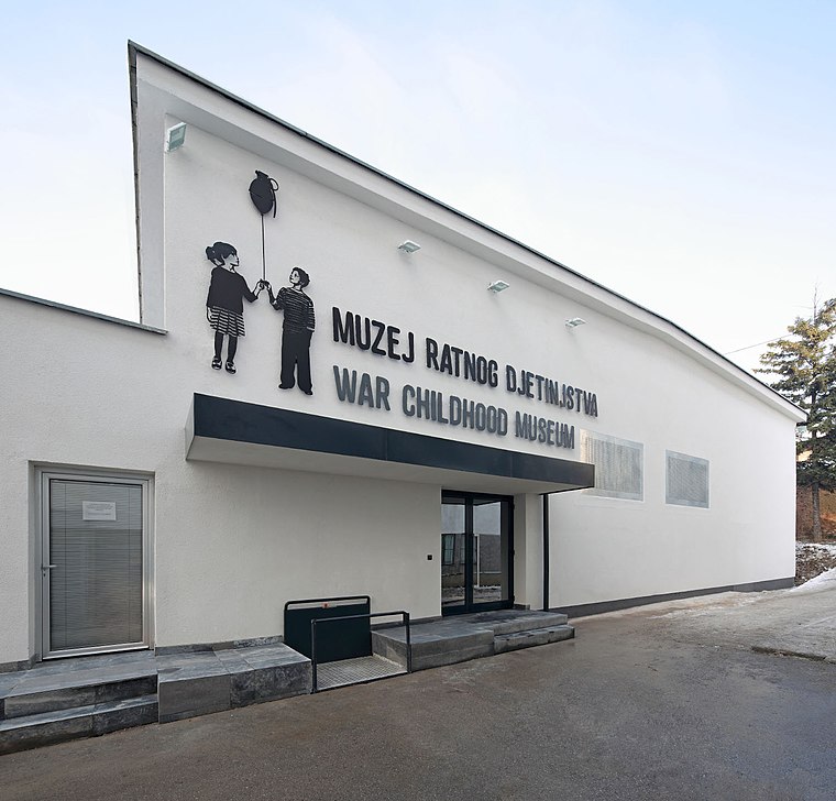
Photo: Wikimedia, CC BY-SA 4.0.
The War Childhood Museum is a historical museum in Sarajevo, Bosnia-Herzegovina that opened in January 2017. The museum presents the experiences of children who lived through the war in Bosnia, told through objects, video testimonies, and excerpts from oral histories. War childhood museum is situated 4 km northwest of PD Trebević.
Sarajevo National Theatre
Theater building

Photo: Slein80, CC BY-SA 2.0 de.
The Sarajevo National Theatre is the largest theatre in Bosnia and Herzegovina and one of the most important cultural institutions in Southeastern Europe. Sarajevo National Theatre is situated 3½ km northwest of PD Trebević.
Places in the Area
Nearby places include Blizanci and Studenkovići.

Studenkovići
Hamlet
Studenkovići is a village in Bosnia and Herzegovina. According to the 1991 census, the village is located in the municipality of Istočni Stari Grad.
Donje Međuše
Hamlet
Donje Međuše is a village in Bosnia and Herzegovina. According to the 1991 census, the village is located in the municipality of Istočni Stari Grad.
PD Trebević
- Type: Mountain hut
- Categories: building, tourism, and accommodation
- Location: Republika Srpska, Bosnia and Herzegovina, Balkans, Europe
- View on OpenStreetMap
Latitude
43.83067° or 43° 49′ 50″ northLongitude
18.44871° or 18° 26′ 55″ eastOpen location code
8FMWRCJX+7FOpenStreetMap ID
way 764209832OpenStreetMap feature
building=yesOpenStreetMap feature
tourism=alpine_hut
This page is based on OpenStreetMap, Wikidata, and Wikimedia Commons.
We’d love your help improving our open data sources. Thank you for contributing.
Satellite Map
Discover PD Trebević from above in high-definition satellite imagery.
Notable Places Nearby
Highlights include Bijela stijena and Tri Budalaša.
Nearby Places
Explore places such as PD Trebević and Dom Jure Franko.
Bosnia and Herzegovina: Must-Visit Destinations
Delve into Sarajevo, Mostar, Banja Luka, and Tuzla.
Curious Mountain Huts to Discover
Uncover intriguing mountain huts from every corner of the globe.
About Mapcarta. Data © OpenStreetMap contributors and available under the Open Database License". Text is available under the CC BY-SA 4.0 license, except for photos, directions, and the map. Photo: Hrast, CC BY-SA 3.0.