Hochbehälter Fürstenwarteweg
Hochbehälter Fürstenwarteweg is a building in Styria, Austria. Hochbehälter Fürstenwarteweg is situated nearby to the cave Einsiedeleihöhle, as well as near the church Vierzehn-Nothelfer-Kirche, Eggenberg.| Tap on a place to explore it |
Places of Interest Nearby
Highlights include Vierzehn-Nothelfer-Kirche, Eggenberg and Rothenburg (Graz).
Vierzehn-Nothelfer-Kirche, Eggenberg
Church

Photo: Stefan Fadinger, CC BY-SA 4.0.
Vierzehn-Nothelfer-Kirche, Eggenberg is a church, which is situated 410 metres east of Hochbehälter Fürstenwarteweg.
Rothenburg (Graz)
Castle

Photo: Stefan Fadinger, CC BY 4.0.
Rothenburg (Graz) is a castle, which is situated 650 metres east of Hochbehälter Fürstenwarteweg.
Archaeology Museum Schloss Eggenberg
Museum

Photo: Thilo Parg, CC BY-SA 3.0.
Archaeology Museum Schloss Eggenberg is situated 570 metres southeast of Hochbehälter Fürstenwarteweg.
Places in the Area
Nearby places include Eggenberg and Smart City Graz.
Eggenberg
Suburb
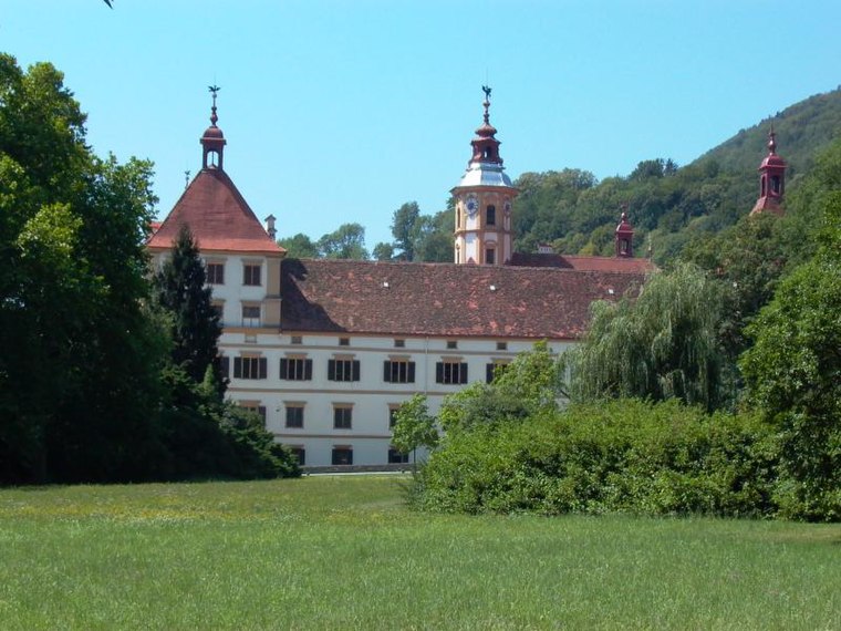
Photo: Robodoc, CC BY-SA 3.0.
Eggenberg is the 14th city district of Graz in the Austrian province of Styria. It borders to the districts of Lend and Gries in the east and to the Plabutsch mountain in the west.

Gösting
Suburb

Photo: Bwag, CC BY-SA 4.0.
Gösting is the 13th city district of Graz, in the Austrian province of Styria. It is situated in the north-west of the city between the river Mur and the Plabutsch mountain and the range north of it on which the ruined Gösting Castle is located.
Hochbehälter Fürstenwarteweg
- Type: Building
- Category: reservoir
- Location: Styria, Austria, Central Europe, Europe
- View on OpenStreetMap
Latitude
47.07942° or 47° 4′ 46″ northLongitude
15.38664° or 15° 23′ 12″ eastOperator
Holding GrazOpen location code
8FVQ39HP+QMOpenStreetMap ID
way 766378809OpenStreetMap feature
building=serviceOpenStreetMap feature
man_made=reservoir_covered
This page is based on OpenStreetMap, Wikidata, and Wikimedia Commons.
We’d love your help improving our open data sources. Thank you for contributing.
Satellite Map
Discover Hochbehälter Fürstenwarteweg from above in high-definition satellite imagery.
Notable Places Nearby
Highlights include Einsiedeleihöhle and Krankenhaus der Elisabethinen Graz-Eggenberg.
Nearby Places
Explore places such as Wohnanlage Holzhof and Alte Weinpresse.
Styria: Must-Visit Destinations
Delve into Graz, Leoben, Bruck an der Mur, and Kapfenberg.
Curious Buildings to Discover
Uncover intriguing buildings from every corner of the globe.
About Mapcarta. Data © OpenStreetMap contributors and available under the Open Database License". Text is available under the CC BY-SA 4.0 license, except for photos, directions, and the map. Photo: Kmarka, CC BY-SA 3.0.