Escuela Santa Rita
Escuela Santa Rita is a school in Santa Rita, Santa Bárbara Department. Escuela Santa Rita is situated nearby to the park Parque Central de Santa Rita, as well as near the church Iglesia de Santa Rita.| Tap on a place to explore it |
Places in the Area
Nearby places include Ceguaca and San Francisco de Ojuera.
Ceguaca
Town
Ceguaca is a municipality in the Honduran department of Santa Bárbara. Ceguaca is situated 7 km northeast of Escuela Santa Rita.
San Francisco de Ojuera
Town
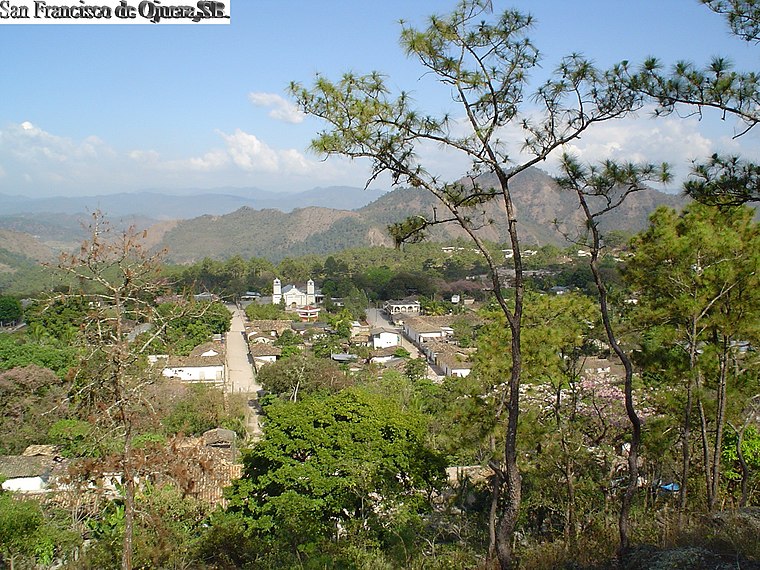
Photo: 1ednp, CC BY-SA 2.5.
San Francisco de Ojuera is a municipality in the Honduran department of Santa Bárbara. San Francisco de Ojuera is situated 7 km east of Escuela Santa Rita.
El Níspero
Town
El Níspero is a municipality in the Honduran department of Santa Bárbara. El Níspero is situated 8 km west of Escuela Santa Rita.
Escuela Santa Rita
- Type: School
- Address: Santa Rita
- Category: education
- Location: Santa Rita, Santa Bárbara Department, Honduras, Central America, North America
- View on OpenStreetMap
Latitude
14.77025° or 14° 46′ 13″ northLongitude
-88.25796° or 88° 15′ 29″ westOpen location code
766HQPCR+4ROpenStreetMap ID
way 769366421OpenStreetMap feature
amenity=school
This page is based on OpenStreetMap, Wikidata, and Wikimedia Commons.
We’d love your help improving our open data sources. Thank you for contributing.
Satellite Map
Discover Escuela Santa Rita from above in high-definition satellite imagery.
Places with the Same Name
Discover other places named “Escuela Santa Rita”.
Notable Places Nearby
Highlights include Parque Central de Santa Rita and Iglesia de Santa Rita.
Nearby Places
Explore places such as Escuela Epaminondas Portillo and Escuela Dr. Miguel Paz Barahona.
Honduras: Must-Visit Destinations
Delve into Tegucigalpa, San Pedro Sula, Roatán, and La Ceiba.
Curious Places to Discover
Uncover intriguing places from every corner of the globe.
About Mapcarta. Data © OpenStreetMap contributors and available under the Open Database License". Text is available under the CC BY-SA 4.0 license, except for photos, directions, and the map. Photo: Wikimedia, CC0.