Salem Central Seventh-Day Adventist
Salem Central Seventh-Day Adventist is a church in Marion, Oregon which is located on Summer Street Northeast. Salem Central Seventh-Day Adventist is situated nearby to the government office OSU Extension Service - Marion, as well as near Grant School Park.| Tap on a place to explore it |
- Type: Church
- Denomination: Seventh Day Adventist
- Address: 1330 Summer Street Northeast, Salem, OR
Places of Interest Nearby
Highlights include Waldo Park and Hallie Ford Museum of Art.
Waldo Park
Park
Waldo Park is a municipal park, located in downtown Salem, Oregon, United States. It is one of the smallest city parks in the world, measuring 12 by 20 feet.
Hallie Ford Museum of Art
Museum
The Hallie Ford Museum of Art is the museum of Willamette University in Salem, Oregon, United States. It is the third largest art museum in Oregon. Opened in 1998, the facility is across the street from the Oregon State Capital in downtown Salem, on the western edge of the school campus. Hallie Ford Museum of Art is situated 1 mile southwest of Salem Central Seventh-Day Adventist.
Reed Opera House and McCornack Block Addition
Shopping center
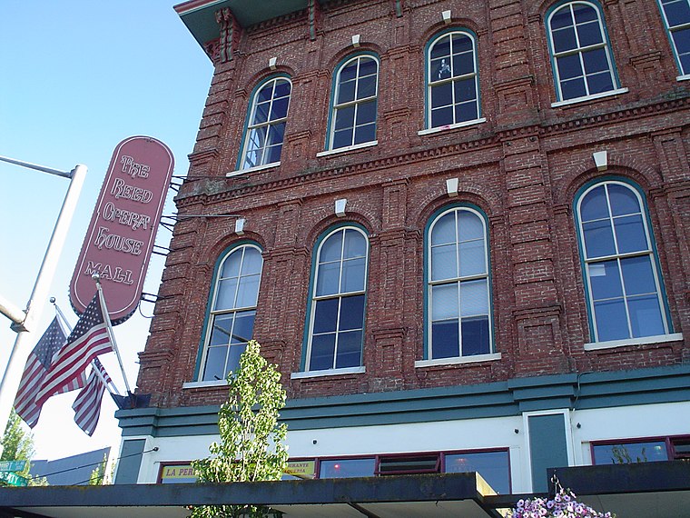
Photo: Andrew Parodi, CC BY-SA 3.0.
The Reed Opera House and McCornack Block Addition, more commonly known as The Reed Opera House or The Reed, is a historic building in downtown Salem, Oregon, United States. Reed Opera House and McCornack Block Addition is situated 1 mile southwest of Salem Central Seventh-Day Adventist.
Places in the Area
Nearby places include Salem and Four Corners.
Salem

Photo: Farwestern, CC BY 3.0.
Salem, the capital of Oregon, is located in the Willamette Valley between Portland and Eugene. It is also the county seat of Marion County. Salem was established in the early 1800s as a farming community.
Four Corners
Quarter
Four Corners is an unincorporated area and census-designated place in Marion County, Oregon, United States, just outside the city limits of Salem but within the city's urban growth boundary. Four Corners is situated 3 miles southeast of Salem Central Seventh-Day Adventist.
Keizer
Town

Photo: Aboutmovies, CC BY 3.0.
Keizer is a city in Marion County, Oregon, United States, along the 45th parallel. As of the 2020 United States census, its population was 39,376, making it the 14th most populous city in Oregon. Keizer is situated 3 miles north of Salem Central Seventh-Day Adventist.
Salem Central Seventh-Day Adventist
- Categories: building, place of worship, and religion
- Location: Marion, Oregon, Pacific Northwest, United States, North America
- View on OpenStreetMap
Latitude
44.95058° or 44° 57′ 2″ northLongitude
-123.02387° or 123° 1′ 26″ westOpen location code
84PRXX2G+6FOpenStreetMap ID
way 782700891OpenStreetMap feature
amenity=place_of_worshipOpenStreetMap feature
building=yesOpenStreetMap attribute
denomination=seventh_day_adventist
This page is based on OpenStreetMap, Wikidata, and Wikimedia Commons.
We’d love your help improving our open data sources. Thank you for contributing.
Satellite Map
Discover Salem Central Seventh-Day Adventist from above in high-definition satellite imagery.
Notable Places Nearby
Highlights include OSU Extension Service - Marion and Grant School Park.
Nearby Places
Explore places such as Eyecare Center of Salem and Wix Agency.
Oregon: Must-Visit Destinations
Delve into Portland, Salem, Eugene, and Astoria.
Curious Churches to Discover
Uncover intriguing churches from every corner of the globe.
About Mapcarta. Data © OpenStreetMap contributors and available under the Open Database License". Text is available under the CC BY-SA 4.0 license, except for photos, directions, and the map. Photo: Wikimedia, CC BY-SA 3.0.