Aire Multimodale Thuir
Aire Multimodale Thuir is a parking area in Thuir, Arrondissement of Céret, Occitanie. Aire Multimodale Thuir is situated nearby to the military installation Gendarmerie nationale, as well as near the health club L’Orange Bleue.| Tap on a place to explore it |
- Opening hours: 24/7
- Type: Parking area
- Parking: surface
Places of Interest Nearby
Highlights include Villa Palauda and Caves Byrrh of Thuir.
Villa Palauda
Manor estate

Photo: LySioS-wkp, CC BY-SA 4.0.
Villa Palauda is a manor estate, which is situated 1 km southwest of Aire Multimodale Thuir.
Caves Byrrh of Thuir
Museum
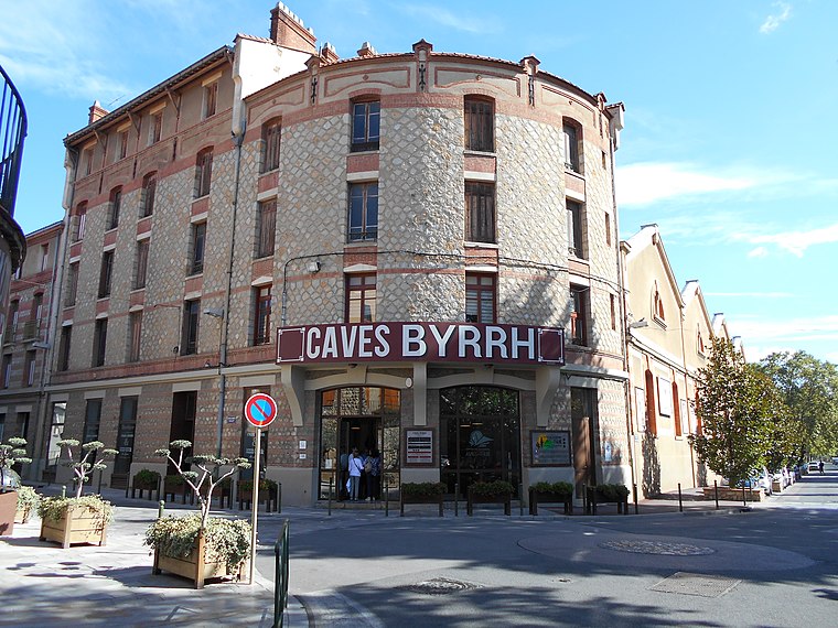
Photo: Claudefà, CC BY-SA 4.0.
Caves Byrrh of Thuir is a museum, which is situated 1¼ km southwest of Aire Multimodale Thuir.
Église Notre-Dame de la Victoire de Thuir
Church

Photo: Palauenc05, CC BY-SA 4.0.
Église Notre-Dame de la Victoire de Thuir is a church, which is situated 1½ km southwest of Aire Multimodale Thuir.
Places in the Area
Nearby places include Llupia and Sainte-Colombe-de-la-Commanderie.
Llupia
Village

Photo: Indif, CC BY-SA 3.0.
Llupia is a commune in the Pyrénées-Orientales department in southern France.
Sainte-Colombe-de-la-Commanderie
Village

Photo: Thérèse Gaigé, CC BY-SA 4.0.
Sainte-Colombe-de-la-Commanderie is a commune in the Pyrénées-Orientales department in southern France. Sainte-Colombe-de-la-Commanderie is situated 3½ km southwest of Aire Multimodale Thuir.
Terrats
Village

Photo: Indif, CC BY-SA 3.0.
Terrats is a commune in the Pyrénées-Orientales department in southern France. Terrats is situated 4 km south of Aire Multimodale Thuir.
Aire Multimodale Thuir
- Category: transportation
- Location: Thuir, Arrondissement of Céret, Pyrénées-Orientales, Occitanie, France, Europe
- View on OpenStreetMap
Latitude
42.64188° or 42° 38′ 31″ northLongitude
2.7684° or 2° 46′ 6″ eastOperator
CD66Open location code
8FJ4JQR9+Q9OpenStreetMap ID
way 783237657OpenStreetMap feature
amenity=parkingOpenStreetMap attribute
parking=surface
This page is based on OpenStreetMap, Wikidata, and Wikimedia Commons.
We’d love your help improving our open data sources. Thank you for contributing.
Satellite Map
Discover Aire Multimodale Thuir from above in high-definition satellite imagery.
Notable Places Nearby
Highlights include Gendarmerie nationale and L’Orange Bleue.
Nearby Places
Explore places such as Les Espassoles and Zone d’Activités Économiques Les Espassoles.
Pyrénées-Orientales: Must-Visit Destinations
Delve into Perpignan, Céret, Collioure, and Arles-sur-Tech.
Curious Parking Areas to Discover
Uncover intriguing parking areas from every corner of the globe.
About Mapcarta. Data © OpenStreetMap contributors and available under the Open Database License". Text is available under the CC BY-SA 4.0 license, except for photos, directions, and the map. Photo: Inkey, CC BY-SA 3.0.