Volkssternwarte Urania Jena
Volkssternwarte Urania Jena is a building in Thuringia, Germany. Volkssternwarte Urania Jena is situated nearby to the scenic viewpoint Forst-Tower, as well as near Touringen Stempelstelle 201 - Schlauer Ux.| Tap on a place to explore it |
Places of Interest Nearby
Highlights include Forst-Tower and Bismarck Tower.
Forst-Tower
Scenic viewpoint

Photo: Xerini, CC BY-SA 3.0.
Forst-Tower is a scenic viewpoint, which is situated 130 metres southeast of Volkssternwarte Urania Jena.
Bismarck Tower
Scenic viewpoint

Photo: Streifengrasmaus, CC BY-SA 2.5.
Bismarck Tower is a scenic viewpoint, which is situated 790 metres northeast of Volkssternwarte Urania Jena.
Jena West station
Railway station

Photo: Daniel Mietchen, CC0.
Jena West station is to the west of the centre of the city of Jena in the German state of Thuringia at the 22.59 km mark of the Weimar–Gera railway between Weimar, Jena-Göschwitz station and Gera Hauptbahnhof. Jena West station is situated 1½ km east of Volkssternwarte Urania Jena.
Places in the Area
Nearby places include Ammerbach and Jena.

Jena
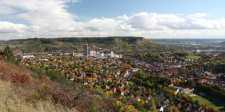
Photo: Lars0001, Public domain.
Jena is a city in the central German state of Thuringia. It is a centre of science and technology with a reputable university, several research institutes and high-tech plants, especially focusing on precision mechanics and optical industries.
Remderoda
Village

Photo: Xerini, CC BY-SA 3.0.
Remderoda is a village, which is situated 2½ km northwest of Volkssternwarte Urania Jena.
Volkssternwarte Urania Jena
- Opening hours:
October—March: Tuesday and Friday 8:00 PM or later
April—September: Saturday 3:00 PM—5:00 PM - Type: Tourist attraction
- Categories: building, tourism, and observatory
- Location: Thuringia, Germany, Central Europe, Europe
- View on OpenStreetMap
Latitude
50.92343° or 50° 55′ 24″ northLongitude
11.55337° or 11° 33′ 12″ eastOperator
Volkssternwarte Urania Jena e.V.Open location code
9F2HWHF3+98OpenStreetMap ID
way 807716627OpenStreetMap feature
building=yesOpenStreetMap feature
man_made=observatoryOpenStreetMap feature
tourism=attraction
This page is based on OpenStreetMap, Wikidata, and Wikimedia Commons.
We’d love your help improving our open data sources. Thank you for contributing.
Satellite Map
Discover Volkssternwarte Urania Jena from above in high-definition satellite imagery.
Places with the Same Name
Discover other places named “Volkssternwarte Urania Jena”.
Notable Places Nearby
Highlights include Touringen Stempelstelle 201 - Schlauer Ux and Osanns Linde.
Nearby Places
Explore places such as Forsthaus and Spechte - Die Baumeister des Waldes.
Curious Places to Discover
Uncover intriguing places from every corner of the globe.
About Mapcarta. Data © OpenStreetMap contributors and available under the Open Database License". Text is available under the CC BY-SA 4.0 license, except for photos, directions, and the map. Photo: Taxiarchos228, FAL.